Contact us

FSC Euro Cup-October 2010-Organizers Bidding

Who should host FSC Euro Cup?

  • Romania & Turkey

    9 69.2%
  • United Kingdom & Poland

    4 30.8%

  • Total voters
    13
  • Poll closed .

AlekS

Veteran
Joined
October 1, 2009
Posts
26,899
Location
Ukraine
:al: :al: :al: :al: :ua: :ua: :ua::ua:

The 3rd host city: DONETSK
don1.png

Donetsk is a large city in the Eastern Ukraine on the Kalmius river. Administratively, it is a center of Donetsk Oblast, while historically, it is the unofficial capital and largest city of the economic and cultural Donets Basin (Donbass) region.
new_tram.jpg


The city was founded in 1869 by a Welsh businessman, John Hughes, who constructed a steel plant and several coal mines in the region; the town was thus named Yuzovka in recognition of his role in its founding ("Yuz" being a Russian or Ukrainian approximation of Hughes). During Soviet times, the city's steel industry was expanded and since 1924 it was renamed Stalino, again renamed after 1961, during the De-Stalinisation to its modern name after the Seversky Donets river. Today, the city still remains an important industrial centre for coal and steel in Ukraine.

The city is currently home to two major professional football teams in Ukraine: Shakhtar Donetsk and Metalurh Donetsk, both of which currently play in the Ukrainian Premier League. Important attractions of the city include the Cathedral Transfiguration of Jesus, the Donetsk National University, and others.

don3.jpg


Donetsk currently has a population of over 982.000 inhabitants (2010) and has a metropolitan area of over 1,566,000 inhabitants (2004). According to the 2001 Ukrainian Census, Donetsk is the fifth-largest city in Ukraine​

don5.png


don6.jpg


The stadium
Donbass Arena
Capacity: 51 504
Donbass_Arena.jpg


don7.jpg

800px-Donbass_Arena_Ball.jpg

(this is a fountain :) the ball turns around, the water moves this heavy thing)​
 

MyHeartIsYours

Well-known member
Joined
May 22, 2010
Posts
24,545
uk.gif


profile no.3 - United Kingdom hosting city: EDINBURGH

Edinburgh%20Skyline%20iStock.jpg


Edinburgh (Scots: Edinburgh/Embra/Emburrie) (Scottish Gaelic: Dùn Èideann) is the capital city of Scotland, the second largest city in Scotland after Glasgow and the seventh-most populous in the United Kingdom. The City of Edinburgh Council is one of Scotland's 32 local government council areas. The council area includes urban Edinburgh and a 30-square-mile (78 km2) rural area.
Located in the south-east of Scotland, Edinburgh lies on the east coast of the Central Belt, along the Firth of Forth, near the North Sea. Owing to its spectacular, rugged setting and vast collection of Medieval and Georgian architecture, including numerous stone tenements, it is often considered one of the most picturesque cities in Europe.
Edinburgh is the seat of the Scottish Parliament. The city was one of the major centres of the Enlightenment, led by the University of Edinburgh, earning it the nickname Athens of the North. The Old Town and New Town districts of Edinburgh were listed as a UNESCO World Heritage Site in 1995. There are over 4,500 listed buildings within the city. In May 2010, it had a total of 40 conservation areas covering 23% of the building stock and 23% of the population, the highest such ratios of any major city in the UK. In the 2009 mid year population estimates, Edinburgh had a total resident population of 477,660. Edinburgh is well-known for the annual Edinburgh Festival, a collection of official and independent festivals held annually over about four weeks from early August. The number of visitors attracted to Edinburgh for the Festival is roughly equal to the settled population of the city. The most famous of these events are the Edinburgh Fringe (the largest performing arts festival in the world), the Edinburgh International Festival, the Edinburgh Military Tattoo, and the Edinburgh International Book Festival. Other events include the Hogmanay street party (31 December), Burns Night (25 January), St. Andrew's Day (30 November), and the Beltane Fire Festival (30 April).
The city attracts 1 million overseas visitors a year, making it the second most visited tourist destination in the United Kingdom, after London. In a 2009 YouGov poll, Edinburgh was voted the "most desirable city in which to live in the UK". Edinburgh was also rated The Best Place to Live in Channel 4's 2007 4Homes survey.

HISTORY EDINBURGH

000028_fd34b08d.jpg


Humans have settled the Edinburgh area from at least the Bronze Age, leaving traces of primitive stone settlements at Holyrood, Craiglockhart Hill and the Pentland Hills for example. Influenced through the Iron Age by Hallstatt and La Tene Celtic cultures from central Europe, by the time the Romans arrived in Lothian at the beginning of the 1st millennium AD, they discovered a Celtic, Brythonic tribe whose name they recorded as Votadini, likely to be a Latin version of the name they called themselves.
By the 12th century Edinburgh was well established, founded upon the famous castle rock, the volcanic crag and tail geological feature shaped by 2 million years of glacial activity. Flourishing alongside it to the east, another community developed around the Abbey of Holyrood, known as Canongate. In the 13th century these both became Royal Burghs and through the late medieval period Edinburgh grew quickly.
In 1492 King James IV of Scotland undertook to move the Royal Court from Stirling to Holyrood, making Edinburgh the national capital.
Edinburgh continued to flourish economically and culturally through the Renaissance period and was at the centre of the 16th century Scottish Reformation and the Wars of the Covenant a hundred years later.
In 1603 King James VI of Scotland succeeded to the English and Irish thrones, fulfilling his ambition to create a united kingdom under the Stuart Monarchy. Although he retained the Parliament of Scotland in Edinburgh, he marched to London to rule from his throne there. He ordered that every public building in the land should bear his family's emblem, the red lion rampant, and to this day the most common name for a public house in Britain is the Red Lion.
In 1707 the Act of Union was ratified by a narrow margin in the Parliament of Scotland, however many Scots had opposed it and the people of Edinburgh rioted at the news. It would be almost 300 years before the Parliament was reinstated.
During the Jacobite rising of 1745, Edinburgh was briefly occupied by Jacobite forces before their march into England.
However following their ultimate defeat at Culloden, there was a period of reprisals and pacification, largely directed at the Catholic Highlanders. In Edinburgh the Hanoverian monarch attempted to gain favour by supporting new developments to the north of the castle, naming streets in honour of the King and his family; George Street, Frederick Street, Hanover Street and Princes Street, named in honour of George III's two sons.
Edinburgh is noted for its fine architecture, and the New Town for its Georgian architecture in particular.
In the 19th century, Edinburgh, like many cities, industrialised, but did not grow as fast as Scotland's second city, Glasgow, which replaced it as the largest city in the country, benefitting greatly at the height of the British Empire.

GEOGRAPHY EDINBURGH

view-of-firth-of-forth.jpg


Bounded by the Firth of Forth to the north and the Pentland Hills, which skirt the periphery of the city to the south, Edinburgh lies in the eastern portion of the Central Lowlands of Scotland. The city sprawls over a landscape which is the product of early volcanic activity and later periods of intensive glaciation. Igneous activity between 350 and 400 million years ago, coupled with faulting led to the dispersion of tough basalt volcanic plugs, which predominate over much of the area. One such example is Castle Rock which forced the advancing icepack to divide, sheltering the softer rock and forming a mile-long tail of material to the east, creating a distinctive crag and tail formation. Glacial erosion on the northern side of the crag gouged a large valley resulting in the now drained Nor Loch. This structure, along with a ravine to the south, formed an ideal natural fortress which Edinburgh Castle was built upon. Similarly, Arthur's Seat is the remains of a volcano system dating from the Carboniferous period, which was eroded by a glacier moving from west to east during the ice age. Erosive action such as plucking and abrasion exposed the rocky crags to the west before leaving a tail of deposited glacial material swept to the east. This process formed the distinctive Salisbury Crags, which formed a series of teschenite cliffs located between Arthur's Seat and the city centre. The residential areas of Marchmont and Bruntsfield are built along a series of drumlin ridges located south of the city centre which were deposited as the glacier receded.
Edinburgh is drained by the Water of Leith, which finds its source at the Colzium Springs in the Pentland Hills and runs for 29 km (18 miles) through the south and west of the city, emptying into the Firth of Forth at Leith. The nearest the river gets to the city centre is at Dean Village on the edge of the New Town, where a deep gorge is spanned by the Dean Bridge, designed by Thomas Telford and built in 1832 for the road to Queensferry. The Water of Leith Walkway is a mixed use trail that follows the river for 19.6 km (12.2 miles) from Balerno to Leith.

CULTURE EDINBURGH

edinburgh_fireworks_470x353.jpg


Culturally, Edinburgh is best known for the Edinburgh Festival, which is a series of separate events, which run from the end of July until early September each year. The longest established festival is the Edinburgh International Festival, which first ran in 1947. The International Festival centres on a programme of high-profile theatre productions and classical music performances, featuring international directors, conductors, theatre companies and orchestras.
The International Festival has since been taken over in both size and popularity by the Edinburgh Fringe. What began as a programme of marginal acts has become the largest arts festival in the world, with 1867 different shows being staged in 2006, in 261 venues. Comedy is now one of the mainstays of the Fringe, with numerous notable comedians getting their 'break' here, often through receipt of the Perrier Award.
In 2008 the largest comedy venues on the Edinburgh Fringe launched as a festival within a festival, labelled the Edinburgh Comedy Festival. Already at its inception it was the largest comedy festival in the world. Alongside these major festivals, there is also the Edinburgh Art Festival, Edinburgh International Film Festival (moved to June from 2008), the Edinburgh Jazz and Blues Festival, and the Edinburgh International Book Festival. The Edge Festival (formerly known as T on the Fringe), a popular music offshoot of the Fringe, began in 2000, replacing the smaller Flux and Planet Pop series of shows.
Running concurrently with the summer festivals, the Edinburgh Military Tattoo occupies the Castle Esplanade every night, with massed pipers and fireworks.
The Edinburgh International Science Festival is held annually in April and is one of the most popular science festivals in the world.
Equally famous is the annual Hogmanay celebration. Originally a street party held on Princes Street and the Royal Mile, the Hogmanay event has been officially organised since 1993. In 1996, over 300,000 people attended, leading to ticketing of the main street party in later years, with a limit of 100,000 tickets. Hogmanay now covers four days of processions, concerts and fireworks, with the street party commencing on Hogmanay. During the street party Princes Street is accessible by ticket only, allowing access into Princes Street where there are live bands playing, food and drink stalls, and a clear view of the castle and fireworks. Alternative tickets are available for entrance into the Princes Street Gardens concert and Ceilidh, where well known artists perform and ticket holders are invited to participate in traditional Scottish Ceilidh dancing. The event attracts thousands of people from all over the world.
On the night of 30 April, the Beltane Fire Festival takes place on Edinburgh's Calton Hill. The festival involves a procession followed by the re-enactment of scenes inspired by pagan spring fertility celebrations. At the beginning of October each year, the Dussehra Hindu Festival is also held on Calton Hill.
Edinburgh has a large number of pubs, clubs and restaurants. The traditional areas were the Grassmarket, Lothian Road and surrounding streets, Rose Street and its surrounds and the Bridges. In recent years George Street in the New Town has grown in prominence, with a large number of new, upmarket public houses and nightclubs opening, along with a number on the parallel Queen Street. Stockbridge and the waterfront at Leith are also increasingly fashionable areas, with a number of pubs, clubs and restaurants.
The largest nightclubs are Lava & Ignite (formerly Cavendish) and City Nightclub, as well as the University of Edinburgh's student union, Potterrow. Smaller commercial venues include Base, Faith, Stereo, and Karma. In recent years night clubs on George Street such as Opal Lounge, Lulu's, Why Not and Shanghai have become popular.

GAY EDINBURGH

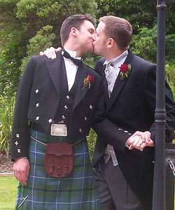
gaywedding4.jpg


As Scotland's cultural, financial and political centre, Edinburgh is fast becoming a mecca for gay travellers from all over the world.
Many visitors come simply to immerse themselves in the history that Edinburgh has to offer, and to view the stunning cityscape.
Others come to enjoy our varied nightlife and theatrical offerings, or visit the numerous museums and galleries which are among the finest in the country.
And of course every August the city is especially popular with visitors who come to enjoy the famous Edinburgh Festival, the world's largest arts festival.
Edinburgh's gay centre is vibrant and exciting, with the choice of gay venues ever-growing. Visitors are assured a warm welcome and rewarding experience.
Whatever your reason for coming to Edinburgh, you will find a city that is both walkable and safe.

TRANSPORT EDINBURGH

queen_mary_2.jpg


Edinburgh Airport is Scotland's busiest airport and principal international gateway to the capital, handling just over 9 million passengers in 2009. In anticipation of rising passenger numbers, the airport operator BAA outlined a draft masterplan in 2006 to provide for the expansion of the airfield and terminal building. The possibility of building a second runway to cope with an increased number of aircraft movements has also been mooted.
As an important hub on the East Coast Main Line, Edinburgh Waverley is the primary railway station serving the city. With more than 14 million passengers per year, the station is the second busiest in Scotland behind Glasgow Central. Waverley serves as the terminus for trains arriving from London King's Cross and is the departure point for many rail services within Scotland operated by First ScotRail.
To the west of the city centre lies Haymarket railway station which is an important commuter stop. Opened in 2003, Edinburgh Park station serves the adjacent business park located in the west of the city and the nearby Gogarburn headquarters of the Royal Bank of Scotland. The Edinburgh Crossrail connects Edinburgh Park with Haymarket, Waverley and the suburban stations of Brunstane and Newcraighall in the east of the city. There are also commuter lines to South Gyle and Dalmeny, which serves South Queensferry by the Forth Bridges, and to the south west of the city out to Wester Hailes and Curriehill
Lothian Buses operate the majority of city bus services within the City and to surrounding suburbs, with the majority of routes running via Princes Street. Services further afield operate from the Edinburgh Bus Station off St. Andrew Square. Lothian, as the successor company to the City's Corporation Trams, also operates all of the City's branded public tour bus services, the night bus network and airport buses. Lothian's Mac Tours subsidiary has one of the largest remaining fleets of ex-London Routemaster buses in the UK, many converted to open top tour buses. In 2007, the average daily ridership of Lothian Buses was over 312,000 - a 6% rise on the previous year.
In order to tackle traffic congestion, Edinburgh is now served by six park and ride sites on the periphery of the city at Sheriffhall, Ingliston, Riccarton, Inverkeithing (in Fife) and Newcraighall. A new facility at Straiton opened in October 2008. A referendum of Edinburgh residents in February 2005 rejected a proposal to introduce congestion charging in the city.
Edinburgh has been without a tram system since 16 November 1956. However, following parliamentary approval in 2007, construction began on a new Edinburgh tram network in early 2008. The first stage of the project was expected to be operational by July 2011 but is unlikely to be working before the beginning of 2012. The first phase will see trams running from the airport in the west of the city, through the centre of Edinburgh and down Leith Walk to Ocean Terminal and Newhaven. The next phase of the project will see trams run from Haymarket through Ravelston and Craigleith to Granton on the waterfront. Future proposals include a line going west from the airport to Ratho and Newbridge, and a line running along the length of the waterfront.

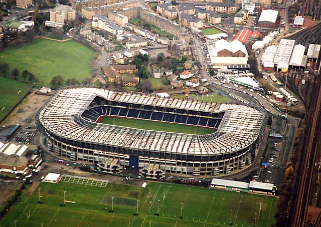
THE ARENA: MURRAYFIELD STADIUM

images

0_buildings_-_murrayfield_stadium_1zm12.jpg


Murrayfield Stadium (usually just known as Murrayfield) is a sports stadium located in the west end of Edinburgh, the capital of Scotland. Its all-seater capacity was recently reduced from 67,800 to 67,130 to incorporate the largest permanent "big screen" in the country though it still remains the largest stadium in Scotland and one of the largest in the United Kingdom overall.
Although mainly a rugby union stadium, Murrayfield has in the past hosted American football, rugby league and association football matches and music concerts. The stadium has seen performances by artists, such as Tina Turner, Celine Dion, David Bowie, Robbie Williams, The Rolling Stones, U2, R.E.M. & The Red Hot Chili Peppers.
In July 2005, Murrayfield hosted the final Live 8 concert, Edinburgh 50,000 - The Final Push, with performances from the likes of James Brown, Texas & The Proclaimers.
British rock group Oasis played a sold-out show on 17 June 2009, as part of their world tour. This was the last time they would play a gig in Scotland and the second time they had played the stadium, the first being on their Standing on the Shoulder of Giants Tour in 2000.

gdgdgdfgfdfgdfdf.png

VOTE POLAND AND UNITED KINGDOM FOR FSC EURO CUP HOSTS
 

goktengri

Banned
Joined
June 16, 2010
Posts
14,347
Location
Turkish Republic
4th Host city in Turkey: Mugla​


mugla.jpg


fethiye.jpg


normal_datca05-mugla.jpg


Region: Aegean

Mu?la is a province of Turkey, at the country's south-western corner, on the Aegean Sea. Its seat is Mu?la, about 20 km (12 miles) inland, while some of Turkey's largest holiday resorts, such as Bodrum, Ölüdeniz, Marmaris and Fethiye, are on the coast in Mu?la.

Bodrum

bodrum.jpg


Bodrum (from Petronium), formerly Halicarnassus, from Ancient Greek: ????????????, (Turkish: Halikarnas), is a Turkish port town in Mu?la Province, in the southwestern Aegean Region of the country. It is located on the southern coast of Bodrum Peninsula, at a point that checks the entry into the Gulf of Gökova, and it faces the Greek island of Kos. Today, it is an international center of tourism and yachting. The city was called Halicarnassus of Caria in ancient times. The Mausoleum of Mausolus, one of the Seven Wonders of the Ancient World, was here.

Bodrum Castle, built by the Crusaders in the 15th century, overlooks the harbor and the International Marina. The castle grounds includes a Museum of Underwater Archeology and hosts several cultural festivals throughout the year.

bodrum-kalesi.jpg


Halikarnas Disco:

826.jpg


Marmaris

marmaris2.jpg


Marmaris is a port city and a tourist destination on the Mediterranean coast, located in southwest Turkey, in the Mu?la Province.

Marmaris' main source of income is tourism. Little is left of the sleepy fishing village that Marmaris was just a few decades ago after a construction boom in the 1980s. Marmaris still retains its charm due to its exceptional location between two intersecting set of mountains by the sea. The town's population is 28,660 (2000) and is estimated to make a peak of 300,000 - 400,000 people during the tourism season. Marmaris' nightlife rivals anything on the Turkish coast.

It is also a major centre for sailing and diving, possessing two major and several smaller marinas. It is a popular wintering location for hundreds of cruising boaters. There are regular ferry services to the Greek island of Rhodes, and large cruise ships call at the port.

yBogaz.jpg


Fethiye

fethiye.jpg


Fethiye (Greek: ?????, Makri or Macri) is a city and district of Mu?la Province in the Aegean region of Turkey with about 68,000 inhabitants (2008).

Fethiye is one of Turkey's well-known tourist centres and is especially popular during the summer.

In the last ten years Fethiye has become a magnet for British citizens. Apart from its climate and natural beauty, the Britons are attracted by its less expensive lifestyle and the hospitality of the local people. The British population in Turkey is between 34,000 and 38,000. As a result of the large British population and the high numbers of Britons going there for holiday, Fethiye-Öludeniz was chosen as the best tourism centre in the world by The Times and The Guardian newspapers in 2007. Over 7,000 British citizens permanently live in Fethiye, while approximately 600,000 British tourists visit the town every summer.

The Fethiye Museum, which is very rich in ancient and more recent artifacts, displays and testifies to the successive chain of civilizations that existed in the area, starting with the ancient Lycians.

Fethiye was formerly known as Makri (?????); the Greeks deported from the area under the terms of the 1923 exchange of populations between Greece and Turkey founded the town of Nea Makri (New Makri) in Greece.

Oludeniz Beach

oludeniz.turlari.jpg


Fethiye City Stadium

166yt92.jpg


Capacity: 10.000

Fethiye City Stadium caught up with UEFA norms.The host team is Fethiyespor.​
 

DominikS

Active member
Joined
March 1, 2010
Posts
1,042
Location
UK/Poland
I'm going on holiday today and the voting starts when I'm away.

Remember to vote for Poland and UK bid!!! It's my birthday soon so do it instead of a birthday present :lol: (ok you don't have to do that)
 

AlekS

Veteran
Joined
October 1, 2009
Posts
26,899
Location
Ukraine
:al: :al: :al: :al: :ua: :ua: :ua: :ua:

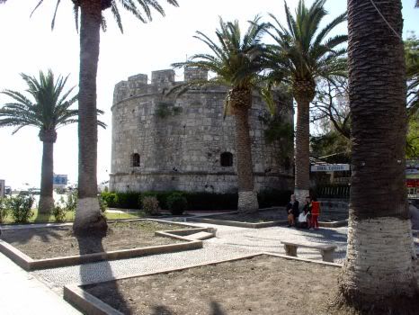
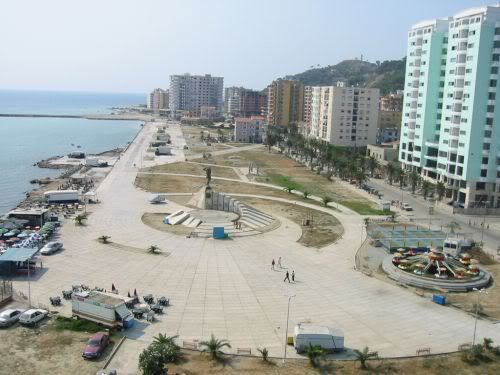
The 4th host city: Durrës

Durres_Beach.JPG


Durrëss is the second largest city of Albania. It is the most ancient and one of the most economically important cities of Albania. It is located on the central Albanian coast, about 33 km (21 mi) west of the capital Tirana. It is situated at one of the narrower points of the Adriatic Sea, opposite the Italian ports of Bari (300 km/186 mi away) and Brindisi (200 km/124 mi away). It has a population of around 202,000 (as of 2009 estimate). The city of Durrës is home to Albania's newest public university, the Aleksander Moisiu University.

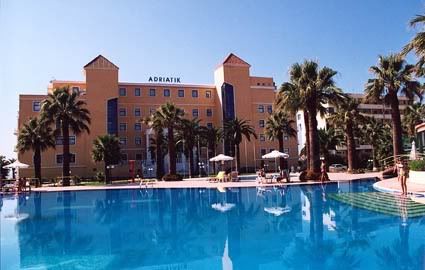
hotel2.jpg


As one of the oldest cities in Europe, the city was founded as Epidamnos in the ancient region of Illyria in 627 BC by Greek colonists from Corinth and Corcyra. The general vicinity of Epidamus was called Epidamnia. The city's geographical position was highly advantageous, as it was situated around a natural rocky harbour which was surrounded by inland swamps and high cliffs on the seaward side, making the city very difficult to attack from either land or sea.
After the Illyrian Wars with the Roman Republic in 229 BC ended in a decisive defeat for the Illyrians the city passed to Roman rule, under which it was developed as a major military and naval base. The Romans renamed it Dyrrachium. Unaffected by the fall of the Western Roman Empire, the city continued under the Byzantine Empire as an important port and a major link between the Empire and Western Europe.

24320Durres20amfiteatrum.jpg


The First Bulgarian Empire under Simeon the Great captured the city, together with most of what is today Albania, in the early 10th century, but the Byzantines reconquered it around the middle of the century, when Bulgaria was under Peter I. The very end of the century saw another period of Bulgarian control, when under Samuel the empire conquered the city and held it until 1018. Afteer that it's been switching between Byzantine and Italian rulers.
In 1333 it was annexed to the Frankish Principality of Achaea before falling to the Serbian Tsar Stefan Dušan in 1336. When Dušan died in 1355, the city passed into the hands of the Albanian family of Thopias.
Durrës became a Christian city quite early on; its bishopric was created around AD 58 and was raised to the status of an archbishopric in 449. It is also the seat of a Greek Orthodox metropolitan bishop. Under Turkish rule, many of its inhabitants converted to Islam and many mosques were created. The city did not prosper under the Ottomans and its importance declined greatly.

durres_para_portit.jpg


The city became Albania's first national capital on March 7, 1913 under the brief rule of Prince William of Wied. Restored to Albanian sovereignty, Durrës became the country's temporary capital between 1918 and March 1920. It experienced an economic boom due to Italian investments and developed into a major seaport under the rule of King Zog, with a modern harbour being constructed in 1927.

n2l46g.jpg


The WWII saw Durrës and the rest of Albania being annexed to the Kingdom of Italy between 1939–1943, then occupied by Nazi Germany until 1944. The city was heavily damaged by Allied bombing during the war and the port installations were blown up by the retreating Germans in 1944.
The Communist regime of Enver Hoxha rapidly rebuilt the city following the war, establishing a variety of heavy industries in the area and expanding the port. It became the terminus of Albania's first railway, begun in 1947. In the late 1980s the city was briefly renamed Durrës-Enver Hoxha.

durres18sb.jpg


Following the collapse of communist rule in 1990, Durrës became the focus of mass emigrations from Albania with ships being hijacked in the harbour and sailed at gunpoint to Italy. In one month alone, August 1991, over 20,000 people migrated to Italy in such way. Italy intervened militarily, putting the port area under its control, and the city became the centre of the European Community's "Operation Pelican", a food-aid programme.
In 1997, Albania slid into anarchy following the collapse of a massive pyramid scheme which devastated the national economy. An Italian-led peacekeeping force was controversially deployed to Durrës and other Albanian cities to restore order, although there were widespread suggestions that the real purpose of "Operation Alba" was to prevent economic refugees continuing to use Albania's ports as a route to migrate to Italy.
During the 1999 Kosovo War the city hosted some 110,000 Deportees from Kosovo.

DR3.jpg


Durrës is still an important link to Western Europe due to its port and its proximity to the Italian port cities, notably Bari, to which daily ferries run. As well as the dockyard, it also possess an important shipyard and manufacturing industries, notably producing leather, plastic and tobacco products. The neighbouring district also produces wine and a variety of foodstuffs.
Some important buildings in Durrës include the main library, the cultural center with the Aleksander Moisiu theater, the Estrada Theater, the puppet theater, and the philharmonic orchestra. There are also several museums such as the Archaeological Museum, Ahmet Zogu Villa of Durrës and the Museum of History.

durres-beach.jpg


The city's beaches are also a popular destination for many foreign and local tourists, with an estimated 600,000 tourists visiting annually. Many Albanians from Tirana and elsewhere spend their summer vacations on the beaches of Durrës.
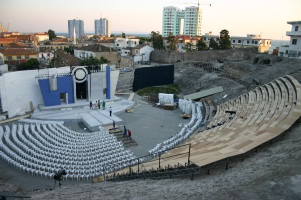
The largest amphitheatre in the Balkans is located in the city close to the harbour. This first-century construction is currently under consideration for inscription as a UNESCO World Heritage site.


The Stadium
Niko Dovana Stadium

Capacity: 12 000
STADIO%20TEUTA%201.jpg
 

MyHeartIsYours

Well-known member
Joined
May 22, 2010
Posts
24,545
uk.gif


profile no.4 - United Kingdom hosting city - BELFAST

aerial_view_belfast.jpg


Belfast is the capital of and the largest city in Northern Ireland. It is the seat of devolved government and legislative Northern Ireland Assembly. It is the largest urban area in Northern Ireland, the second-largest city in Ireland and the 15th-largest city in the United Kingdom. It is the main settlement in the province of Ulster. The city of Belfast has a population of 267,500 and lies at the heart of the Belfast urban area, which has a population of 483,418. The Belfast metropolitan area has a total population of 579,276. Belfast is also the 100th-largest urban zone in the EU. Belfast was granted city status in 1888.
Historically, Belfast has been a centre for the Irish linen industry (earning the nickname "Linenopolis"), tobacco production, rope-making and shipbuilding: the city's main shipbuilders, Harland and Wolff, which built the ill-fated RMS Titanic, propelled Belfast on to the global stage in the early 20th century as the largest and most productive shipyard in the world. Belfast played a key role in the Industrial Revolution, establishing its place as a global industrial centre until the latter half of the 20th century.
Industrialisation and the inward migration it brought made Belfast, if briefly, the largest city in Ireland at the turn of the 20th century and the city's industrial and economic success was cited by Ulster unionist opponents of Home Rule as a reason why Ireland should shun devolution and later why Ulster in particular would fight to resist it.
Today, Belfast remains a centre for industry, as well as the arts, higher education and business, a legal centre, and is the economic engine of Northern Ireland. The city suffered greatly during the period of disruption, conflict, and destruction called the Troubles, but latterly has undergone a sustained period of calm, free from the intense political violence of former years, and substantial economic and commercial growth. Belfast city centre has undergone considerable expansion and regeneration in recent years, notably around Victoria Square.
Belfast is served by two airports: George Best Belfast City Airport in the city, and Belfast International Airport 15 miles (24 km) west of the city.
Belfast is also a major seaport, with commercial and industrial docks dominating the Belfast Lough shoreline, including the famous Harland and Wolff shipyard.
Belfast is a constituent city of the Dublin-Belfast corridor, which has a population of 3 million, or half the total population of the island of Ireland.

HISTORY BELFAST

titanic_500px.jpg


Belfast became a substantial settlement in the 17th century after being established as a town by Sir Arthur Chichester, which was initially settled by Protestant English and Scottish migrants at the time of the Plantation of Ulster. (Belfast and County Antrim, however, did not form part of the Plantation scheme.) In 1791, the Society of United Irishmen was founded in Belfast, after Henry Joy McCracken and other prominent Presbyterians from the city invited Theobald Wolfe Tone and Thomas Russell. to a meeting, after having read Tone's "Argument on Behalf of the Catholics of Ireland". Evidence of this period of Belfast's growth can still be seen in the oldest areas of the city, known as the Entries.
Belfast blossomed as a commercial and industrial centre in the 18th and 19th centuries and became Ireland's pre-eminent industrial city. Industries thrived, including linen, rope-making, tobacco, heavy engineering and shipbuilding, and at the end of the nineteenth century, Belfast briefly overtook Dublin as the largest city in Ireland. The Harland and Wolff shipyards became one of the largest shipbuilders in the world, employing up to 35,000 workers. The shipyard built the ill-fated White Star Liner 'Titanic' and its sister ships, 'Olympic' and 'Britannic'.
In 1920-22, Belfast became the capital of the new entity of Northern Ireland as the island of Ireland was partitioned. The accompanyinging conflict (the Irish War of Independence) cost up to 500 lives in Belfast, the bloodiest sectarian strife in the city until the "Troubles" of the late 1960s onwards.
Belfast was heavily bombed during World War II. In one raid, in 1941, German bombers killed around one thousand people and left tens of thousands homeless. Outside of London, this was the greatest loss of life in a night raid during the Blitz.
Belfast has been the capital of Northern Ireland since its establishment in 1921 following the Government of Ireland Act 1920. Since its emergence as a major city, it had been the scene of various episodes of sectarian conflict between its Roman Catholic and Protestant populations. These opposing groups in this conflict are now often termed republican and loyalist respectively, although they are also referred to as 'nationalist' and 'unionist'. The most recent example of this conflict was known as the Troubles – a civil conflict that raged from around 1969 to the late 1990s. Belfast saw some of the worst of the Troubles in Northern Ireland, particularly in the 1970s, with rival paramilitary groups formed on both sides. Bombing, assassination and street violence formed a backdrop to life throughout the Troubles. The Provisional IRA detonated 22 bombs within the confines of Belfast city centre in 1972, on what is known as "Bloody Friday", killing nine people. The IRA also killed hundreds of other civilians and members of the security forces trying to keep the peace. Loyalist paramilitaries including the Ulster Volunteer Force (UVF) and the Ulster Defence Association (UDA) claimed that the killings they carried out were in retaliation for the IRA campaign. Most of their victims were Roman Catholic civilians with no links to the Provisional IRA. A particularly notorious group, based on the Shankill Road in the mid 1970s, became known as the Shankill Butchers. In all, over 1,500 people were killed in political violence in the city from 1969 until 2001. Part of the legacy of the Troubles is that both republican and loyalist paramilitary groups in Belfast have become involved in organised crime and racketeering.

GEOGRAPHY BELFAST

Belfast%20Lough%20at%20dusk.jpg


Belfast is situated on Ireland's eastern coast. The city is flanked to the northwest by a series of hills, including Cavehill. Belfast is located at the western end of Belfast Lough and at the mouth of the River Lagan making it an ideal location for the shipbuilding industry that once made it famous. When the Titanic was built in Belfast in 1911/1912, Harland and Wolff had the largest shipyard in the world. Belfast is situated on Northern Ireland's eastern coast. A consequence of this northern latitude is that it both endures short winter days and enjoys long summer evenings. During the winter solstice, the shortest day of the year, local sunset is before 16:00 while sunrise is around 08:45. This is balanced by the summer solstice in June, when the sun sets after 22:00 and rises before 05:00.
In 1994, a weir was built across the river by the Laganside Corporation to raise the average water level so that it would cover the unseemly mud flats which gave Belfast its name (from Irish: Béal Feirste meaning "The sandy ford at the river mouth").The area of Belfast Local Government District is 42.3 square miles (110 km2).
The River Farset is also named after this silt deposit (from the Irish feirste meaning "sand spit"). Originally a more significant river than it is today, the Farset formed a dock on High Street until the mid 19th century. Bank Street in the city centre referred to the river bank and Bridge Street was named for the site of an early Farset bridge. However, superseded by the River Lagan as the more important river in the city, the Farset now languishes in obscurity, under High Street.
The city is flanked on the north and northwest by a series of hills, including Divis Mountain, Black Mountain and Cavehill thought to be the inspiration for Jonathan Swift's Gulliver's Travels. When Swift was living at Lilliput Cottage near the bottom of the Limestone Road in Belfast, he imagined that the Cavehill resembled the shape of a sleeping giant safeguarding the city. The shape of the giant's nose, known locally as Napoleon's Nose, is officially called McArt's Fort probably named after Art O'Neill, a 16th century chieftain who controlled the area at that time. The Castlereagh Hills overlook the city on the southeast.
Belfast has a temperate climate. Average daily high temperatures are 18 °C (64 °F) in July and 6 °C (43 °F) in January. The highest temperature recorded in Belfast was 30.8 °C (87.4 °F) on 12 July 1983. The city gets significant precipitation (greater than 0.01 in/0.25 mm) on 213 days in an average year with an average annual rainfall of 846 millimetres (33.3 in), less than the Lake District or the Scottish Highlands, but higher than Dublin or the south-east coast of Ireland. As an urban and coastal area, Belfast typically gets snow on fewer than 10 days per year. The city is also renowned for how warm it can get during the winter months at its high latitude. In February, temperatures have hit 17 °C, at the same latitude where it is ~-45 °C in Russia and Canada. It is not uncommon for temperatures in summer to reach as high as 27 °C (80 °F) on numerous days. The consistently humid climate that prevails over the British Isles can make temperatures feel uncomfortable when they stray into the high 20s (80–85 °F), more so than similar temperatures in hotter climates in the rest of Europe.

TRANSPORT BELFAST

4231065536_0d84171404.jpg


Belfast is a relatively car-dependent city by European standards, with an extensive road network including the 22.5 miles (36 km) M2 and M22 motorway route. A recent survey of how people travel in Northern Ireland showed that people in Belfast made 77% of all journeys by car, 11% by public transport and 6% on foot. It also showed that Belfast has 0.70 cars per household compared to figures of 1.18 in the East and 1.14 in the West of Northern Ireland. A significant road improvement-scheme in Belfast began early in 2006, with the upgrading of two junctions along the Westlink dual-carriageway to grade-separated standard. The improvement scheme was completed five months ahead of schedule on February 2009, with the official opening taking place on 4th March 2009. Commentators have argued that this may simply create a bottleneck at York Street, the next at-grade intersection, until that too is upgraded. The York Street phase is currently at the review stage and if successfully completing the necessary statutory procedures, work on a grade separated junction to connect the Westlink to the M2/M3 motorways is scheduled to take place between 2013/14 to 2017/2018, creating a continuous link between the M1 and M2, the two main motorways in Northern Ireland.
Black taxis are common in the city, operating on a share basis in some areas. These, however, are outnumbered by private hire taxis. Bus and rail public transport in Northern Ireland is operated by subsidiaries of Translink. Bus services in the city proper and the nearer suburbs are operated by Translink Metro, with services focusing on linking residential districts with the city centre on twelve quality bus corridors running along main radial roads, resulting in poor connections between different suburban areas. More distant suburbs are served by Ulsterbus. Northern Ireland Railways provides suburban services along three lines running through Belfast's northern suburbs to Carrickfergus and Larne, eastwards towards Bangor and south-westwards towards Lisburn and Portadown. This service is known as the Belfast Suburban Rail system. Belfast also has a direct rail connection with Dublin called Enterprise which is operated jointly by NIR and Iarnród Éireann, the state railway company of the Republic of Ireland.
In April 2008, the DRD reported on a plan for a light-rail system, similar to Dublin. The consultants said Belfast does not have the population to support a light rail system, suggesting that investment in bus-based rapid transit would be preferable.The study found that bus-based rapid transit produces positive economic results, but light rail does not. The report by Atkins & KPMG, however, said there would be the option of migrating to light rail in the future should the demand increase.
The city has two airports: the Belfast International Airport offers domestic, European and transatlantic flights and is located north-west of the city, near Lough Neagh, while the George Best Belfast City Airport, which is closer to the city centre, adjacent to Belfast Lough, offers UK domestic flights and a few European flights. In 2005, Belfast International Airport was the 11th busiest commercial airport in the UK, accounting for just over 2% of all UK terminal passengers while the George Best Belfast City Airport was the 16th busiest and had 1% of UK terminal passengers.
Belfast has a large port which is used for exporting and importing goods, and for passenger ferry services. Stena Line run regular routes to Stranraer in Scotland using its HSS (High Speed Service) vessel – with a crossing time of around 90 minutes – and/or its conventional vessel – with a crossing time of around 3 hours 45 minutes. Norfolkline – formally Norse Merchant Ferries – offers a passenger/cargo ferry to and from Liverpool, with a crossing time of 8 hours and a seasonal sailing to Douglas, Isle of Man is operated by the Isle of Man Steam Packet Company.

CULTURE BELFAST

131621.jpg


Belfast's population is evenly split between its Protestant and Catholic residents. These two distinct cultural communities have both contributed significantly to the city's culture. Throughout the Troubles, Belfast artists continued to express themselves through poetry, art and music. In the period since the Good Friday Agreement in 1998, Belfast has begun a social, economic and cultural transformation giving it a growing international cultural reputation. In 2003, Belfast had an unsuccessful bid for the 2008 European Capital of Culture. The bid was run by an independent company, Imagine Belfast, who boasted that it would "make Belfast the meeting place of Europe's legends, where the meaning of history and belief find a home and a sanctuary from caricature, parody and oblivion."
In 2004–05, art and cultural events in Belfast were attended by 1.8 million people (400,000 more than the previous year). The same year, 80,000 people participated in culture and arts activities, twice as many as in 2003–04. A combination of relative peace, international investment and an active promotion of arts and culture is attracting more tourists to Belfast than ever before. In 2004–05, 5.9 million people visited Belfast, a 10% increase from the previous year, and spent UK£262.5 million.
The Ulster Orchestra, based in Belfast, is Northern Ireland's only full-time symphony orchestra and is well renowned in the United Kingdom. Founded in 1966, it has existed in its present form since 1981, when the BBC Northern Ireland Orchestra was disbanded. The music school of Queen's University is responsible for arranging a notable series of lunchtime and evening concerts, often given by renowned musicians which are usually given in The Harty Room at the university (University Square).
There are many Traditional Irish bands playing throughout the city and quite a few music schools concentrate on teaching Traditional music. Well known city centre venues would include Kelly's Cellars, Maddens and the Hercules bar. Famous artists would include The McPeakes, Brian Kennedy and the band 9Lies.
Musicians and bands who have written songs about or dedicated to Belfast: U2, Van Morrison, Snow Patrol, Simple Minds, Elton John, Katie Melua, Boney M, Paul Muldoon, Stiff Little Fingers, Nanci Griffith, Glenn Patterson, Orbital, James Taylor, Spandau Ballet, The Police, Barnbrack, Gary Moore.
Further in Belfast the Oh Yeah Music Centre is located (Cathedral Quarter), a project founded to give young musicians and artists a place where they can share ideas and kick-start their music careers as chance to been supported and promoted by professional musicians of Northern Ireland's music-scene.
Although, like the rest of Northern Ireland, the city has no 'mother-tongue' community of Irish speakers, the language is heavily promoted in the city and Belfast has the highest concentration of Irish speakers in the north. Projects to promote the language in the city are funded by various sources, notably FORAS NA GAEILGE, an all-Ireland body funded by both the Irish and British governments. There are a number Irish language Primary schools and one secondary school in Belfast, this however is not funded by the British exchequer as it is funded by individual fundraisers and the charity TACA.
Belfast's nightlife has steadily become more and more vibrant since the end of the troubles. The City Centre is now home to numerous pubs, bars and clubs.

GAY BELFAST

i.aspx


Belfast's gay scene is thriving and, it's safe to say, it is one of the more liberal-minded cities in Europe. In fact, in 2005 under the new Civil Partnership Act, Belfast was the first UK city to hold a same-sex civil partnership ceremony.
The annual Belfast Pride Festival attracts thousands of revellers to our wee city and is the largest of its kind on the island of Ireland. With a selection of damn fine gay/friendly pubs and clubs, they've come to the right place to have a proverbial ball.

THE VENUE: ODSSEY ARENA

odyssey.jpg

image.aspx


The Odyssey is a large sports and entertainment centre, situated in Titanic Quarter.
The Arena has hosted concerts by some of the best-selling music artists in the world, including Cher, Bob Dylan, Bruce Springsteen & The E Street Band, Queen + Paul Rodgers, Pearl Jam, Metallica, P!nk, Beyoncé, Backstreet Boys, Justin Timberlake, Def Leppard, Styx, REO Speedwagon, Rihanna, Chris Brown, Kanye West, N.E.R.D, Ciara, David Jordan, 50 Cent, Take That, New Kids on the Block, Lady Gaga, Pussycat Dolls, Kings of Leon, Oasis & Snow Patrol, among others.
During concerts it has a capacity of 14000 (Standing) and 10000 (All-seating).

gdgdgdfgfdfgdfdf.png

VOTE POLAND AND UNITED KINGDOM FOR FSC EURO CUP HOSTS
 

MyHeartIsYours

Well-known member
Joined
May 22, 2010
Posts
24,545
uk-map-big.jpg


profile no.5 - United Kingdom hosting city - LIVERPOOL

DSC_2803-Edit.jpg


Liverpool is a city and metropolitan borough of Merseyside, England, along the eastern side of the Mersey Estuary. It was founded as a borough in 1207 and was granted city status in 1880. Liverpool is the fourth largest city in the United Kingdom (third largest in England) and has a population of 435,500, and lies at the centre of the wider Liverpool Urban Area, which has a population of 816,216.
Historically a part of Lancashire, the urbanisation and expansion of Liverpool were largely brought about by the city's status as a major port. By the 18th century, trade from the West Indies, Ireland and mainland Europe coupled with close links with the Atlantic Slave Trade furthered the economic expansion of Liverpool. By the early 19th century, 40% of the world's trade passed through Liverpool's docks, contributing to Liverpool's rise as a major city.
Inhabitants of Liverpool are referred to as Liverpudlians but are also known as "Scousers", in reference to the local dish known as "scouse", a form of stew. The word "Scouse" has also become synonymous with the Liverpool accent and dialect. Liverpool's status as a port city has contributed to its diverse population, which, historically, were drawn from a wide range of peoples, cultures, and religions, particularly those from Ireland. The city is also home to the oldest Black African community in the country and the oldest Chinese community in Europe.
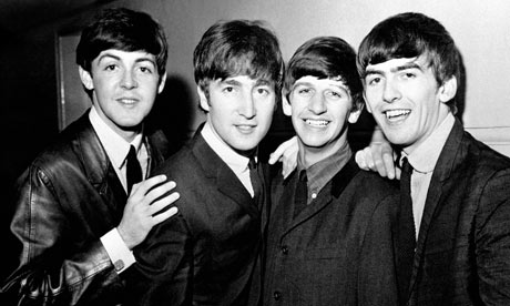
The popularity of The Beatles and the other groups from the Merseybeat era contributes to Liverpool's status as a tourist destination; tourism forms a significant part of the city's modern economy. In 2007 the city celebrated its 800th anniversary, and in 2008 it held the European Capital of Culture title together with Stavanger, Norway.
In 2004, several areas throughout the city centre were granted World Heritage Site status by UNESCO. Referred to as the Liverpool Maritime Mercantile City, the site comprises six separate locations in the city including the Pier Head, Albert Dock and William Brown Street and includes many of the city's most famous landmarks.

HISTORY LIVERPOOL

A020869.jpg


King John's letters patent of 1207 announced the foundation of the borough of Liverpool, but by the middle of the 16th century the population was still only around 500. The original street plan of Liverpool is said to have been designed by King John near the same time it was granted a royal charter, making it a borough.
In the 17th century there was slow progress in trade and population growth. Battles for the town were waged during the English Civil War, including an eighteen-day siege in 1644. In 1699 Liverpool was made a parish by Act of Parliament, that same year its first slave ship, Liverpool Merchant, set sail for Africa. As trade from the West Indies surpassed that of Ireland and Europe, and as the River Dee silted up, Liverpool began to grow. The first commercial wet dock was built in Liverpool in 1715. Substantial profits from the slave trade helped the town to prosper and rapidly grow. By the close of the century Liverpool controlled over 41% of Europe's and 80% of Britain's slave commerce.
By the start of the 19th century, 40% of the world's trade was passing through Liverpool and the construction of major buildings reflected this wealth. In 1830, Liverpool and Manchester became the first cities to have an intercity rail link, through the Liverpool and Manchester Railway. The population continued to rise rapidly, especially during the 1840s when Irish migrants began arriving by the hundreds of thousands as a result of the Great Famine. By 1851, approximately 25% of the city's population was Irish-born. During the first part of the 20th century, Liverpool was drawing immigrants from across Europe.
The Housing Act 1919 resulted in mass council housing building across Liverpool during the 1920s and 1930s. Thousands of families were rehoused from the inner-city to new suburban housing estates, based on the pretext that this would improve their standard of living, though this is largely subjective. A large number of private homes were also built during this era. The process continued after the Second World War, with many more new housing estates being built in suburban areas, while some of the older inner city areas where also redeveloped for new homes.
During the Second World War there were 80 air-raids on Merseyside, killing 2,500 people and causing damage to almost half the homes in the metropolitan area. Significant rebuilding followed the war, including massive housing estates and the Seaforth Dock, the largest dock project in Britain. Much of the immediate reconstruction of the city centre has been deeply unpopular, and was as flawed as much town planning renewal in the 1950s and 1960s – the portions of the city's heritage that survived German bombing could not withstand the efforts of urban renewal. Since 1952 Liverpool has been twinned with Cologne, Germany, a city which also experienced aerial bombing during the war.
From the mid-1970s onwards Liverpool's docks and traditional manufacturing industries went into sharp decline. The advent of containerisation meant that the city's docks became largely obsolete. In the early 1980s unemployment rates in Liverpool were among the highest in the UK. In recent years, Liverpool's economy has recovered and has experienced growth rates higher than the national average since the mid-nineties.

GEOGRAPHY LIVERPOOL

Richard-squirrel-formby.jpg


Liverpool has been described as having "the most splendid setting of any English city." At 176 miles (283 km) northwest of London, the city of Liverpool is built across a ridge of sandstone hills rising up to a height of around 230 feet (70 metres) above sea-level at Everton Hill, which represents the southern boundary of the West Lancashire Coastal Plain. Liverpool Urban Area runs directly into Bootle, Crosby and Maghull in south Sefton to the north, and Kirkby, Huyton, Prescot and Halewood in Knowsley to the east. It faces Wallasey and Birkenhead across the River Mersey to the west.
Formby, to the north of the city, has an extensive dune system and forest which is home to many rare species including the Red Squirrel and Natterjack Toad.
Liverpool experiences a temperate maritime climate, like much of the British Isles, with relatively cool summers and mild winters.

TRANSPORT LIVERPOOL

806_27_8673---Mersey-Ferry--Liverpool_web.jpg


Transport in Liverpool is primarily centred around the city's road and rail networks, both of which are extensive and provide links across the United Kingdom. Liverpool has an extensive local public transport network, which is managed by the Merseytravel, and includes buses, trains and ferries. Additionally, the city also has an international airport and a major port, both of which provides links to locations outside the country.
As a major city, Liverpool has direct road links with many other areas within England. To the east, the M62 motorway connects Liverpool with Hull and along the route provides links to several large cities, including Manchester, Leeds and Bradford. The M62 also provides a connection to both the M6 motorway and M1 Motorway, providing indirect links to more distant areas including Birmingham, Sheffield, Preston, London and Nottingham. To the west of the city, the Kingsway and Queensway Tunnels connect Liverpool with the Wirral Peninsula, providing links to both Birkenhead, and Wallasey. The A41 road, which begins in Birkenhead, also provides links to Cheshire and Shropshire and via the A55 road, North Wales. To the south, Liverpool is connected to Widnes and Warrington via the A562 road and subsequently across the River Mersey to Runcorn, via the Silver Jubilee Bridge. Plans have been developed in recent years to construct a second bridge, known as the Mersey Gateway, across the river in order to alleviate congestion on the route today.
Liverpool is served by two separate rail networks. The local rail network is managed and run by Merseyrail and provides links throughout Merseyside and beyond (see Local Travel below), while the national network, which is managed by Network Rail, provides Liverpool with connections to major towns and cities across the England. The city's primary mainline station is Lime Street station, which acts as a terminus for several lines into the city. Train services from Lime Street provide connections to numerous destinations, including London (in 2 hours 8 minutes with Pendolino tilting trains), Birmingham, Newcastle upon Tyne, Manchester, Preston, Leeds, Scarborough, Sheffield, Nottingham and Norwich. In the south of the city, Liverpool South Parkway provides a connection to the city's airport.
The Port of Liverpool is one of Britain's largest ports, providing passenger ferry services across the Irish Sea to Belfast, Dublin and the Isle of Man. Services are provided by several companies, including the Isle of Man Steam Packet Company, P&O and Norfolkline. In 2007, a new cruise liner terminal, the Princes' Dock, was opened in Liverpool, located alongside the Pier Head in the city centre. The terminal allows cruise ships to dock in the city (40 ships arrived during 2009) and also provide a base for trans-Atlantic services.
Liverpool John Lennon Airport, which is located in the south of the city, provides Liverpool with direct air connections across the United Kingdom and Europe. In 2008, the airport handled over 5.3 million passengers and today offers services to 68 destinations, including Berlin, Rome, Milan, Paris, Barcelona and Zurich.
Liverpool's local rail network is one of the busiest and most extensive in the country, covering 75 miles of track, with an average of 100,000 passenger journeys per weekday. Services are operated by the Merseyrail franchise and managed by the Merseyside Passenger Transport Executive. The network consists of three lines: the Northern Line, which runs to Southport, Ormskirk, Kirkby and Hunts Cross; the Wirral Line, which runs through the Mersey Railway Tunnel and has branches to New Brighton, West Kirby, Chester and Ellesmere Port; and the City Line, which begins at Lime Street, providing links to St Helens, Wigan, Preston, Warrington and Manchester. It should be noted that local services on the city line are operated by Northern Rail rather than Merseyrail, although the line itself remains part of the Merseyrail network. Within the city centre the majority of the network is underground, with five city centre stations and over 6.5 miles of tunnels.
The cross river ferry service in Liverpool, known as the Mersey Ferry, is managed and operated by Merseytravel, with services operating between the Pier Head in Liverpool and both Woodside in Birkenhead and Seacombe in Wallasey. Services operate at intervals ranging from 20 minutes at peak times, to every hour during the middle of the day and during weekends. Despite remaining an important transport link between the city and the Wirral Peninsula, the Mersey Ferry has become an increasingly popular tourist attraction within the city, with daytime River Explorer Cruises providing passengers with an historical overview of the River Mersey and surrounding areas.

CULTURE LIVERPOOL

The-Beatles-in-1963-002.jpg


As with other large cities, Liverpool is an important cultural centre within the United Kingdom, incorporating music, performing arts, museums and art galleries, literature and nightlife amongst others. In 2008, the cultural heritage of the city was celebrated with the city holding the title of European Capital of Culture, during which time a wide range of cultural celebrations took place in the city, including Go Superlambananas! and La Princesse.
Musicians from the city have produced 56 number one singles, more than any other city in the world. Both the most successful male band and girl group in global music history have contained Liverpudlian members. Liverpool is most famous as the birthplace of The Beatles and during the 1960s was at the forefront of the Beat Music movement, which would eventually lead to British Invasion. Many notable musicians of the time originated in the city including Billy J Kramer, Cilla Black, Gerry & the Pacemakers and The Searchers. The influence of musicians from Liverpool, coupled with other cultural exploits of the time, such as the Liverpool poets, prompted American poet Allen Ginsburg to proclaim that the city was "the centre of consciousness of the human universe". Other musicians from Liverpool have included Billy Fury, Echo and the Bunnymen, Frankie Goes to Hollywood, Frankie Vaughan and more recently The Zutons, Atomic Kitten and Heidi Range.
Liverpool has more galleries and national museums than any other city in the United Kingdom apart from London. National Museums Liverpool is the only English national collection based wholly outside London. The Tate Liverpool gallery houses the modern art collection of the Tate in the North of England and was, until the opening of Tate Modern, the largest exhibition space dedicated to modern art in the United Kingdom. The FACT centre hosts touring multimedia exhibitions, while the Walker Art Gallery houses an extensive collection of Pre-Raphaelites. Sudley House contains another major collection of pre 20th century art, and the number of galleries continues to expand: Ceri Hand Gallery opened in 2008, exhibiting primarily contemporary art, and Liverpool University's Victoria Building was re-opened as a public art gallery and museum to display the University's artwork and historical collections which include the second-largest display of art by Audubon outside the US.

GAY LIVERPOOL - LIVERPOOL GAY QUARTER

liverpool-pride.jpg


Liverpool's Gay Quarter encompasses Stanley Street, Cumberland Street, Victoria St and Eberle St, and is where the bulk of the gay bars and clubs are located in Liverpool, in North West England. Stanley St is the main hub of the Gay Quarter and is where most of the bars are found.
VisitBritain, Britain's national tourism agency, acknowledges Liverpool as one of Britain's most notable gay cities, and recognises the growing investment in the Gay Quarter. Liverpool City Council hopes that further investment in the area, including partial pedestrianisation will further promote Liverpool as a gay destination.
Every year in November, the city hosts 'Homotopia', a two-week festival of gay culture including theatre, film, photography, and art. Launched in 2004, and supported by the Arts Council England, the celebration has now become a highlight of Liverpool's cultural calendar. The festival is directed by Gary Everett, an esteemed member of the local gay community, who has also been involved in the running of several of Liverpool's gay nightclubs. In contrast to a traditional 'Pride' festival, Homotopia is a forum to showcase GLBT talent in the field of arts, photography, performance etc., and is designed to bring together creative individuals irrespective of sexuality. Shows and events take place in theatres and galleries around Liverpool, and tend to be separate from the traditional gay scene. The opening and closing ceremonies do, however, often involve some form of club night.
Homotopia has been attended by numerous high profile figures from international gay society, including Peter Tatchell, Holly Johnson, Armistead Maupin, and Amy Lame. Homotopia also represents the gay community with its own float in Liverpool's annual Lord Mayor's Parade, along with other communities in the city.
'Our Story Liverpool', one of the projects associated with Homotopia, has also provided an opportunity to celebrate, record and archive the history and heritage of LGBT Liverpool, through the sharing of stories and experiences from members of the community. Before the project, much of the history had either been forgotten or ignored.
Liverpool also has its own LGBT Film Festival: 'Outsiders', directed by Matthew Fox, which brings the latest in gay film to the city. Since its inception in 2004, audience figures have grown considerably, and some experts say it is fast becoming one of the UK's leading gay film festivals, continuing to bring gay film premieres to Liverpool.
Liverpool also competes against other UK cities in the annual Mr Gay UK beauty competition, with the representative from the city participating in the national final. The winner of Mr Gay Europe 2007, Jackson Netto, was a student at Liverpool University, however, he represented Germany and not United Kingdom.

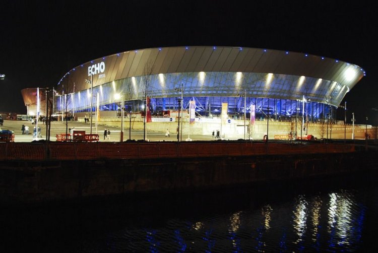
THE VENUE: ECHO ARENA LIVERPOOL

LR%20Liverpool%20Echo%20Arena%20-%20Night.jpg

4108340701_6e25fc451d.jpg


Echo Arena Liverpool is the arena half of ACC (Arena and Convention Centre) Liverpool located on the former King's Dock in Liverpool, England, United Kingdom. The BT Convention Centre forms the other half of the complex. Although the Echo Arena itself opened in January 2008, the ACC as a whole was officially opened by Her Majesty Queen Elizabeth II and Prince Philip during their visit to Liverpool on 22 May 2008.
The arena and convention centre complex is capable of hosting a whole range of events including music concerts, conventions, sporting events, children's entertainment and more. Since the arena's opening in 2008, it has regularly played host to many of the world's top musical acts. Many world famous artists including Oasis, Lady Gaga, Nickelback, Queen + Paul Rodgers, Rihanna and Beyoncé have performed at the Arena, with the latter on three separate occasions in the space of a year. As well as concerts, the arena has also hosted a number of major international events.
On 6 November 2008 the arena hosted the 2008 MTV Europe Music Awards, whilst on 14 December 2008 it was the venue for the BBC Sports Personality of the Year show.
Since its completion in 2008 the arena has become home to the Liverpool Summer Pops Festival, which takes place each year. The festival, which until previous years had operated from a huge big top tent, regularly attracts a number of well known popular artists.
The Echo Arena is set to hold host to the MOBO Awards on 20 October 2010, this will be only the second time that the awards have been held outside of London.
The arena has a capacity of 11000.

gdgdgdfgfdfgdfdf.png

VOTE POLAND AND UNITED KINGDOM FOR FSC EURO CUP HOSTS
 

MyHeartIsYours

Well-known member
Joined
May 22, 2010
Posts
24,545
poland-map.gif


profile no.1 - Poland hosting city: WARSAW

zlota44_2.jpg


Warsaw (Polish: Warszawa) is the capital and largest city of Poland. It is located on the Vistula River roughly 360 kilometers (224 mi) from the Baltic Sea and 300 kilometers (186 mi) from the Carpathian Mountains. Its population as of June 2009 was estimated at 1,711,466, and the Warsaw metropolitan area at approximately 2,785,000. The city area is 516.9 square kilometers (199.6 sq mi), with an agglomeration of 6,100.43 square kilometers (2,355.4 sq mi) (Warsaw Metro Area – Obszar Metropolitalny Warszawy). Warsaw is the 9th largest city in the European Union by population.
Warszawianka (1831) (French: La Varsovienne) is widely considered the unofficial anthem of Warsaw. On 9 November 1940 the City of Warsaw was awarded the highest military decoration for courage in the face of the enemy - Order Virtuti Militari for the heroic defence in 1939.
Warsaw is also known as the "phoenix city", as it recovered from extensive damage during World War II (during which 80% of its buildings were destroyed), being rebuilt with the effort of Polish citizens, and the Soviet Union. Warsaw has given its name to the Warsaw Confederation, Warsaw Pact, the Duchy of Warsaw, Warsaw Convention, Treaty of Warsaw and the Warsaw Uprising.

GEOGRAPHY WARSAW

ISS006-E-10173.JPG


Warsaw lies in east-central Poland about 300 km (190 mi) from the Carpathian Mountains and about 260 km (160 mi) from the Baltic Sea, 523 km (325 mi) east of Berlin, Germany.[12] The city straddles the Vistula River. It is located in the heartland of the Masovian Plain, and its average elevation is 100 metres (330 ft) above sea level, although there are some hills (mostly artificial) located within the confines of the city.
Warsaw is located on two main geomorphologic forms: the plain moraine plateau and the Vistula Valley with its asymmetrical pattern of different terraces. The Vistula River is the specific axis of Warsaw, which divides the city into two parts, left and right. The left one is situated both on the moraine plateau (10 to 25 m (32.81 to 82.02 ft) above Vistula level) and on the Vistula terraces (max. 6.5 m (21.33 ft) above Vistula level). The significant element of the relief, in this part of Warsaw, is the edge of moraine plateau called Warsaw Escarpment. It is 20 to 25 m (65.62 to 82.02 ft) high in the Old Town and Central district and about 10 m (32.81 ft) in the north and south of Warsaw. It goes through the city and plays an important role as a landmark.
The plain moraine plateau has only a few natural and artificial ponds and also groups of clay pits. The pattern of the Vistula terraces is asymmetrical. The left side consist mainly of two levels: the highest one contains former flooded terraces and the lowest one the flood plain terrace. The contemporary flooded terrace still has visible valleys and ground depressions with water systems coming from the Vistula old - riverbed. They consist of still quite natural streams and lakes as well as the pattern of drainage ditches. The right side of Warsaw has a different pattern of geomorfological forms. There are several levels of the plain Vistula terraces (flooded as well as former flooded once) and only small part and not so visible moraine escarpment. Aeolian sand with a number of dunes parted by peat swamps or small ponds cover the highest terrace. These are mainly forested areas (pine forest).
Warsaw's climate is humid continental (Koppen Dfb) with relatively cool winters and mild summers. The average temperature is ?3 °C (27 °F) in January and 19.3 °C (66.7 °F) in July. Temperatures may often reach 30 °C (86 °F) in the summer. Yearly rainfall averages 495 millimeters (19.5 in), the most rainy month being July. Spring and Autumn (Fall) are usually beautiful seasons, the former crisp and sunny and full of blooms and the latter alternately sunny and misty, and cool but not cold.

HISTORY WARSAW

warsawghettouprising.gif

:cry: :cry: :cry: :cry: :cry:

The first fortified settlements on the site of today's Warsaw were Bródno (9th/10th century) and Jazdów (12th/13th century). After Jazdów was raided, a new similar settlement was established on the site of a small fishing village called Warszowa. The P?ock prince Boles?aw II of Masovia, established this settlement, the modern Warsaw, about 1300. In the beginning of the 14th century it became one of the seats of the Dukes of Masovia, becoming the capital of Masovia in 1413. Fourteenth-century Warsaw's economy rested on crafts and trade. Upon the extinction of the local ducal line, the duchy was reincorporated into the Polish Crown in 1526.
In 1529 Warsaw for the first time became the seat of the General Sejm, permanent from 1569. In 1573 the city gave its name to the Warsaw Confederation, formally establishing religious freedom in the Polish–Lithuanian Commonwealth. Due to its central location between the Commonwealth's capitals of Kraków and Vilnius, Warsaw became the capital of the Commonwealth, and of the Polish Crown, in 1596, when King Sigismund III Vasa moved the court from Kraków to Warsaw.
Warsaw remained the capital of the Polish-Lithuanian Commonwealth until 1795, when it was annexed by the Kingdom of Prussia to become the capital of the province of South Prussia. Liberated by Napoleon's army in 1806, Warsaw was made the capital of the newly created Duchy of Warsaw. Following the Congress of Vienna of 1815, Warsaw became the center of the Congress Poland, a constitutional monarchy under a personal union with Imperial Russia. The Royal University of Warsaw was established in 1816.
Following the repeated violations of the Polish constitution by the Russians, the 1830 November Uprising broke out. However, the Polish-Russian war of 1831 ended in the uprising's defeat and in the curtailment of the Kingdom's autonomy. On 27 February 1861 a Warsaw crowd protesting against the Russian rule over Poland was fired upon by the Russian troops. Five people were killed. The Underground Polish National Government resided in Warsaw during January Uprising in 1863–4.
The Russian Empire Census of 1897 recorded 626,000 people living in Warsaw, making it the third-largest city of the Empire after Saint Petersburg and Moscow.
Warsaw became the capital of the newly independent Poland in 1918. In the course of the Polish-Bolshevik War of 1920, the huge Battle of Warsaw was fought on the Eastern outskirts of the city in which the capital was successfully defended and the Red Army defeated.[38] Poland stopped by itself the full brunt of the Red Army and defeated an idea of the "export of the revolution".
During World War II, central Poland, including Warsaw, came under the rule of the General Government, a German Nazi colonial administration. All higher education institutions were immediately closed and Warsaw's entire Jewish population – several hundred thousand, some 30% of the city – herded into the Warsaw Ghetto. When the order came to annihilate the Ghetto as part of Hitler's "Final Solution" on April 19, 1943, Jewish fighters launched the Warsaw Ghetto Uprising. Despite being heavily outgunned and outnumbered, the Ghetto held out for almost a month. When the fighting ended, almost all survivors were massacred, only few managed to escape or hide.
By July 1944, the Red Army was deep into Polish territory and pursuing the Germans toward Warsaw. Knowing that Stalin was hostile to the idea of an independent Poland, the Polish government-in-exile in London gave orders to the underground Home Army (AK) to try to seize control of Warsaw from the Germans before the Red Army arrived. Thus, on 1 August 1944, as the Red Army was nearing the city, the Warsaw Uprising began. The armed struggle, planned to last 48 hours, went on for 63 days. (Stalin gave orders to his troops to wait out the uprising, so that the Soviet Army could take credit for liberating the Polish capital). Eventually the Home Army fighters and civilians assisting them were forced to capitulate. They were transported to PoW camps in Germany, while the entire civilian population was expelled. Polish civilian deaths are estimated at between 150,000 and 200,000.
The Germans then razed Warsaw to the ground. Hitler, ignoring the agreed terms of the capitulation, ordered the entire city to be razed to the ground and the library and museum collections taken to Germany or burned. Monuments and government buildings were blown up by special German troops known as Verbrennungs- und Vernichtungskommando ("Burning and Destruction Detachments"). About 85% of the city had been destroyed, including the historic Old Town and the Royal Castle.
On January 17, 1945 - after the beginning of the Vistula–Oder Offensive of the Red Army - Soviet troops entered the ruins of the city of Warsaw, and liberated Warsaw's suburbs from German occupation. The city was swiftly taken by the Soviet Army, which rapidly advanced towards ?ód?, as German forces regrouped at a more westward position.
In 1945, after the bombing, the revolts, the fighting, and the demolition had ended, most of Warsaw lay in ruins.
After the war, under a Communist regime set up by the conquering Soviets, large prefabricated housing projects were erected in Warsaw to address the housing shortage, along with other typical buildings of an Eastern Bloc city, such as the Palace of Culture and Science. The city resumed its role as the capital of Poland and the country's centre of political and economic life. Many of the historic streets, buildings, and churches were restored to their original form. In 1980, Warsaw's historic Old Town was inscribed onto UNESCO's World Heritage list.
John Paul II's visits to his native country in 1979 and 1983 brought support to the budding solidarity movement and encouraged the growing anti-communist fervor there. In 1979, less than a year after becoming pope, John Paul celebrated Mass in Victory Square in Warsaw and ended his sermon with a call to "renew the face" of Poland: Let Thy Spirit descend! Let Thy Spirit descend and renew the face of the land! This land! These words were very meaningful for the Polish citizens who understood them as the incentive for the democratic changes.
In 1995, the Warsaw Metro opened. With the entry of Poland into the European Union in 2004, Warsaw is currently experiencing the biggest economic boom of its history. The opening match of UEFA Euro 2012 is scheduled to take place in Warsaw.

TRANSPORT WARSAW

307pWarsaw%20Metro%20Plac%20Wilsona.jpg


Warsaw ring road has been planned consisting of three express roads: S2, S8 and S17. Currently parts of S2 and S8 are under construction and to be completed up to 2012. The city has one international airport, Warsaw Frederic Chopin Airport, located just 10 kilometers (6 mi) from the city centre. With around 100 international and domestic flights a day and with over 9,268,551 passengers served in 2007, it is by far the biggest airport in Poland.
Public transport in Warsaw includes buses, trams (streetcars), metro, light rail Warszawska Kolej Dojazdowa line and regional rail. Regional rail is operated by Szybka Kolej Miejska (Fast Urban Rail) and Koleje Mazowieckie (Mazovian Railoads). There are also some suburban bus lines run by private operators. Bus service covers the entire city, with approximately 170 routes totalling about 2,603 kilometers (1,617 mi) long, and with some 1,600 vehicles.
Currently, the Tramwaje Warszawskie (Warsaw Trams) company runs 863 cars on over 240 kilometers (149 mi) of tracks. Twenty-odd lines run across the city with additional lines opened on special occasions (such as All-Saints Day).
The first section of the Warsaw Metro was opened in 1995 initially with a total of 11 stations. It now has 21 stations running a distance of approximately 23 kilometres. Initially, all of the trains were Russian built. In 1998, 108 new carriages were ordered from Alstom. The second line running east-west will be about 31 kilometres. The central section is now in the bidding stage and will be 6 km. long with seven stations. The main railway station is Warszawa Centralna serving both domestic traffic to almost every major city in Poland, and international connections. There are also five other major railway stations and a number of smaller suburban stations.

CULTURE WARSAW

palace-of-culture-and-science-palac-kultury-i-nauki-warsaw-p-254_4.jpg


Warsaw is home to over 30 major theatres spread throughout the city, including the National Theatre (founded in 1765) and the Grand Theatre in Warsaw (established 1778).
Warsaw also attracts many young and off-stream directors and performers who add to the city's theatre culture. Their productions may be viewed mostly in smaller theatres and Houses of Culture (Domy Kultury), mostly outside ?ródmie?cie (downtown Warsaw). Warsaw hosts the International Theatrical Meetings.
Thanks to numerous musical venues, including the Teatr Wielki, the Polish National Opera, the Chamber Opera, the National Philharmonic Hall and the National Theatre, as well as the Roma and Buffo music theatres and the Congress Hall in the Palace of Culture and Science, Warsaw hosts many events and festivals. Among the events worth particular attention are: the International Frederick Chopin Piano Competition, the International Contemporary Music Festival Warsaw Autumn, the Jazz Jamboree, Warsaw Summer Jazz Days, the International Stanis?aw Moniuszko Vocal Competition, the Mozart Festival, and the Festival of Old Music.
The levelling of Warsaw during the war has left gaping holes in the city's historic collections. And although a considerable amount of treasures were spirited away to safety as the storm clouds gathered in 1939, it is also true that a great number of collections from palaces and museums in the countryside were brought to Warsaw at that time as the capital was considered a safer place than some remote castle in the borderlands. Thus losses were heavy.
Yet in spite of this, Warsaw still boasts some wonderful museums. As interesting examples of expositions the most notable are: the world’s first Museum of Posters boasting one of the largest collections of art posters in the world, Museum of Hunting and Riding and the Railway Museum. From among Warsaw’s 60 museums, the most prestigious ones are National Museum with a wide collection of works whose origin ranges in time from antiquity till the present epoch as well as one of the best collections of paintings in the country and Museum of the Polish Army whose set portrays the history of arms.

GAY WARSAW

18poland-popup.jpg


Being gay in Poland is no easier than being gay in any deeply Catholic, formerly Communist, state - in other words, it's no walk in the park. But modern Warsaw is the most open city in Poland when it comes to the acceptance of homosexuality, and many gay and lesbian Poles will also tell you it's also the place with the most gay and gay-friendly clubs. There are a selection gay clubs and cafes, and even hostels and hotels for the gay or lesbian traveller, as well as some Polish websites of various GLBT organizations and communities.

THE VENUE: NATIONAL STADIUM
warsaw_stadium1.jpg

10dp2.jpg

The National Stadium (Polish: Stadion Narodowy) is a football stadium nearing completion in Warsaw, on the site of the former stadium Stadion Dziesi?ciolecia
The new stadium will have a seating capacity of 55,000. Its construction started in 2008 and is due to host the opening match (a group match), remaining 2 group matches, a quarterfinal, and a semifinal of the UEFA Euro 2012 hosted jointly by Poland and Ukraine.
Along with the stadium the plans include constructing a general purpose indoor sports arena with places for 15,000 spectators, an olympic swimming pool for 4,000 spectators and an aquatic park, hotel and congress center, catering and service facilities. The construction will be followed by a complete refurbishment of the nearby Warsaw Stadium railway station and the opening of a subway station and a segment of the second line of the Warsaw Metro linking the area with the city center. As the grounds are the property of government the investment will be financed by it, rather than the city of Warsaw.


gdgdgdfgfdfgdfdf.png

VOTE POLAND AND UNITED KINGDOM FOR FSC EURO CUP HOSTS
 

AlekS

Veteran
Joined
October 1, 2009
Posts
26,899
Location
Ukraine
:al: :al: :al: :al: :ua: :ua: :ua: :ua:

The 5th host city: Kharkiv

har0.jpg


Kharkiv is the 2nd largest city in Ukraine. Founded in 1654, Kharkiv became the first city in Ukraine where the Soviet power was proclaimed and Soviet government was formed. Now it is the administrative centre of the Kharkiv oblast (province), as well as the administrative centre of the surrounding Kharkivskyi Raion (district) within the oblast. The city is located in the northeast of the country. As of 2007, its population is 1,461,300.

Archeological evidence discovered in the area of present-day Kharkiv indicates that a local population has existed in that area since the 2nd millennium BC. Cultural artifacts date back to the Bronze Age, as well as those of later Scythian and Sarmatian settlers. There is also evidence that the Chernyakhov culture flourished in the area from the 2nd to the 6th century.

har3.jpg


Founded in the middle of 17th century by the eponymous, near-legendary character called Kharko, the settlement became a city in 1654. Kharkiv became the centre of the Sloboda cossack legion. The city had a fortress with underground passageways.
Prior to the formation of the Soviet Union, Bolsheviks established Kharkiv as the capital of the Ukrainian Socialist Soviet Republic (from 1919–1934) in opposition to the Ukrainian People's Republic with its capital of Kyiv.
In the early 1930s, the Holodomor (Great hunger) famine drove many people off the land into the cities, and to Kharkiv in particular, in search of food. Many people died and were secretly buried in mass graves in the cemeteries surrounding the city.
In 1934 hundreds of Ukrainian writers, intellectuals and cultural workers were arrested and executed in the attempt to eradicate all vestiges of Ukrainian nationalism in Art. The purges continued into 1938. Blind Ukrainian street musicians were also gathered in Kharkiv and murdered by the NKVD.
During April and May 1940 about 3,800 Polish prisoners of Starobelsk camp were executed in the Kharkiv NKVD building, later secretly buried on the grounds of an NKVD pansionat in Pyatykhatky forest (part of the Katyn massacre). The site also contains the numerous bodies of Ukrainian cultural workers who were arrested and shot in the 1937-38 Stalinist purges.
During WWII 70% of the city was destroyed and tens of thousands of the inhabitants were killed. Kharkiv was the most populous city in the Soviet Union captured by Nazis. The significant Jewish population of Kharkiv (Kharkiv's Jewish community prided itself with the 2nd largest synagogue in Europe) suffered greatly during the war. Between December 1941 and January 1942, an estimated 30,000 people (slightly more than half Jewish) were killed and buried in a mass grave by the Germans in a ravine outside of town named Drobitsky Yar.

har6.jpg


In the Post WWII period Kharkiv was the third largest scientific-industrial centre in the former USSR (after Moscow and Leningrad). Much of the destroyed homes and factories were rebuilt. Gas lines were installed for heating in government and later private homes. An underground train system was started in 1978. An airport was built in 1954.

State-owned industrial giants, such as Turboatom and Elektrotyazhmash occupy 17% of the heavy power equipment construction (e.g., turbines) market worldwide. Multipurpose aircraft are produced by the Antonov aircraft manufacturing plant. The Malyshev factory produces not only armoured fighting vehicles, but also harvesters. Khartron is the leading designer of space and commercial control systems in Ukraine and the former CIS :cool:

har7.jpg


Kharkiv is one of the most prolific centres of higher education and research of Eastern Europe. The city has 13 national universities and numerous professional, technical and private higher education institutions, offering its students a wide range of disciplines. A total number of 150,000 students attend the universities and other institutions of higher education in Kharkiv. About 9,000 foreign students from 96 countries study in the city. More than 17,000 faculty and research staff are employed in the institutions of higher education in Kharkiv :)

har9.jpg


Kharkiv is a major cultural, scientific, educational, transport and industrial centre of Ukraine, with 60 scientific Institutes, 30 establishments of higher education, 6 museums, 7 theatres and 80 libraries. Its industry specializes mostly in machinery. There are hundreds of industrial companies in the city. Among them are world famous giants like the Morozov Design Bureau and the Malyshev Tank Factory, leaders in tank production since the 1930s; Khartron (aerospace and nuclear electronics); and the Turboatom turbines producer.

har2.jpg


There is an underground rapid-transit system (metro) with about 35 km (22 mi) of track and 28 stations. A well-known landmark of Kharkiv is the Freedom Square (Maidan Svobody formally formerly known as Dzerzhinsky Square), which is currently the sixth largest city square in Europe, and the 10th largest square in the world.

har5.jpg


In 2007, the Vietnamese minority in Kharkiv built the largest Buddhist temple in Europe on a territory of 1 hectare with a monument to Ho Chi Minh.

har8.jpg


The stadium
Metalist Arena
stad_metallist_4_12_9.jpg


photo_1260490193_be6f7.jpg


9ed4e51695a3dcae645297da9218.jpeg


52.jpg

(the view before the opening)
 

goktengri

Banned
Joined
June 16, 2010
Posts
14,347
Location
Turkish Republic
5th Host city in Turkey: Eskisehir​


eskisehir-resim-resimleri-resmi.jpg

cep-x_com_eskisehir_gece_manzara_resimleri1.jpg

9490denizkaplanesesnightbb3.jpg


Region: Central Anatolia

Eskişehir is a city in northwestern Turkey and the capital of the Eskişehir Province. According to the 2009 census, the population of the city is 617,215. The city is located on the banks of the Porsuk River, 792 m above sea level, where it overlooks the fertile Phrygian Valley. In the nearby hills one can find hot springs. The city is 233 km (145 mi) to the west of Ankara, 330 km (205 mi) to the southeast of Istanbul and 78 km (48 mi) to the northeast of Kütahya. The district covers an area of 2,678 km2 (1,034 sq mi).

The name Eskişehir literally means Old City in Turkish; indeed the city was founded by the Phrygians in about 1000 BC. Many Phrygian artifacts and sculptures can still be found in its Archeological Museum. There is also a museum of meerschaum stone, whose production remains still notable, used to make high quality meerschaum pipes. In the fourth century AD the city moved about ten km northeast, from Karadja Hissar (Karacahisar) to Shehir Euyuk (Şehirhöyük.)
Whenever it was mentioned by ancient geographers, the city was described as one of the most beautiful in Anatolia.
As with many towns in Anatolia, Christianity arrived after Constantine the Great made it the official religion of the Roman Empire. Beginning in the 4th century, records exist of bishops holding office in Eskişehir. The city was known as Dorylaeum, then. One of these bishops, Eusebius, was heavily involved in shaping the evolving dogma of the church.

Modern-day Eskişehir is one of Turkey's foremost industrial cities. Traditionally dependent on flour-milling and brickyards, the city expanded with the building of railway workshops in 1894 for work on the Berlin-Baghdad Railway. Eskişehir was also the site of Turkey's first aviation industry (Aeronautical Supply Maintenance Centre) and its air base was the command center of Turkey's first Tactical Air Force headquarters on NATO's southern flank during the Cold War.
Eskişehir is one of the largest industrial centres of Turkey, with several modern industries, producing trucks, home appliances, railway locomotives, fighter aircraft engine, agricultural equipment, textiles, brick, cement, chemicals, processed meerschaum and refined sugar.

The city has a significant population of Crimean Tatars. It also attracted ethnic Turks emigrating from Bulgaria, Romania, Bosnia and Sandžak who contributed to the development of the city's metalworking industries.

Porsuk River

2226-eskisehir_porsuk_cayi.jpg


Tepebasi

11249779.jpg


Estram (Tram Service)

estram-gece.jpg


Anadolu University

anadolu__niversitesi.jpg


Eskisehir Ataturk Stadium

Eskişehir Atatürk Stadium is a multi-purpose stadium in Eskişehir, Turkey. It is currently used mostly for football matches and is the home ground of Eskişehirspor. The stadium holds 13,520 people and was built in 1953. It was named after the Turkish statesman Mustafa Kemal Atatürk.

Owner: Eskişehirspor

Capacity: 13,520

22758.jpg

Eskisehir-Atatrk-Stadyumu.jpg

66291046lc2.jpg
 
Last edited:

MyHeartIsYours

Well-known member
Joined
May 22, 2010
Posts
24,545
It's a shame that UK/Poland and Ukraine/Albania are doing badly. I thought we put a lot of effort into our bids :(.
Turkey and Romania has 1 more point that us 2 put together! :lol:
 

MyHeartIsYours

Well-known member
Joined
May 22, 2010
Posts
24,545
polandmap.gif


profile no. 2 / Poland hosting city: KRAKOW

krakow_poland.jpg


Kraków also spelled Krakow or Cracow, is the second largest and one of the oldest cities in Poland. Its historic centre was inscribed on the list of World Heritage Sites as the first of its kind. Situated on the Vistula River (Polish: Wisła) in the Lesser Poland region, the city dates back to the 7th century. Kraków has traditionally been one of the leading centres of Polish academic, cultural and artistic life and is one of Poland's most important economic centres. It was the capital of Poland from 1038 to 1596; the capital of the Grand Duchy of Kraków from 1846 to 1918; and the capital of Kraków Voivodeship from the 14th century to 1999. It is now the capital of the Lesser Poland Voivodeship.
The city has grown from a Stone Age settlement to Poland's second most important city. It began as a hamlet on Wawel Hill and was already being reported as a busy trading center of Slavonic Europe in 965. With the establishment of new universities and cultural venues at the emergence of the Second Polish Republic and throughout the 20th century, Kraków reaffirmed its role as a major national academic and artistic center.
After the invasion of Poland by Nazi Germany at the start of World War II, Kraków was turned into the capital of Germany's General Government. The Jewish population of the city was moved into a walled zone known as the Kraków Ghetto, from which they were sent to extermination camps such as Auschwitz and the concentration camp at Płaszów.
In 1978—the same year UNESCO placed Kraków on the list of World Heritage Sites—Karol Wojtyła, archbishop of Kraków, was elevated to the papacy as Pope John Paul II, the first non-Italian pope in 455 years and the first ever Slavic pope.

HISTORY KRAKOW

PodgorzeGhettoKick.jpg


Following the invasion of Poland in September 1939, the Nazi German forces turned the city into the capital of the General Government, a colonial authority headed by Hans Frank and seated in Wawel Castle. In an operation called "Sonderaktion Krakau", more than 180 university professors and academics were arrested and sent to Sachsenhausen and Dachau concentration camps, though the survivors were later released on the request of prominent Italians. The Jewish population was first confined to a ghetto and later murdered or sent to concentration camps, including Płaszów and Auschwitz in Oświęcim. Roman Polański, the film director, is a survivor of the Ghetto, while Oskar Schindler, the German businessman portrayed in the Steven Spielberg film Schindler's List, selected employees from the Ghetto to work in his enamelware plant (known as Emalia), thus saving them from the camps.
Kraków remained relatively undamaged at the end of World War II. After the war, under the Stalinist regime, the intellectual and academic community of Kraków was put under total political control. The universities were soon deprived of their printing rights as well as their autonomy. The communist government of the People's Republic of Poland ordered construction of the country's largest steel mill in the newly created suburb of Nowa Huta. The creation of the giant Lenin Steelworks (now Sendzimir Steelworks owned by Mittal) sealed Kraków's transformation from a university city to an industrial center. The new working class, drawn by the industrialization of the city, contributed to its rapid population growth. Also, in an effort that spanned two decades, Karol Wojtyła, cardinal archbishop of Kraków, successfully lobbied for permission to build the first churches in the new industrial suburbs.
In 1978, UNESCO placed Kraków on the list of World Heritage Sites. In the same year, Karol Wojtyła was elevated to the papacy as John Paul II, the first non-Italian pope in 455 years.

GEOGRAPHY KRAKOW

europe_2004.1073813880.kra32.jpg


Kraków lies in the southern part of Poland, on the Vistula River, in a valley at the foot of the Carpathian Mountains, 219 meters (719 ft) above sea level; half way between the Jurassic Rock Upland (Polish: Jura Krakowsko-Częstochowska) to the north, and the Tatra Mountains 100 kilometers (62 mi) to the south, constituting the natural border with Slovakia and the Czech Republic; 230 km west from the border with Ukraine. There are five nature reserves in Kraków, with a combined area of ca. 48.6 hectares (120 acres). Due to their ecological value, these areas are legally protected. The western part of the city, along its northern and north-western side, borders an area of international significance known as the Jurassic Bielany-Tyniec refuge. The main motives for the protection of this area include plant and animal wildlife and the area's geomorphological features and landscape. Another part of the city is located within the ecological 'corridor' of the Vistula River valley. This corridor is also assessed as being of international significance as part of the Pan-European ecological network. The city center is situated on the left (northern) bank of the river.
Kraków has an Oceanic climate (Cfb) according to the Köppen climate classification system, one of the easternmost localities in Europe to do so (East of Tarnów, and north of Kielce the January mean dips below −3 °C (27 °F) and thus becomes continental (Dfb) in nature). The city features a temperate climate. Average temperatures in summer range from 18 °C (64 °F) to 19.6 °C (67 °F) and in winter from −2.1 °C (28 °F) to 0 °C (32 °F). The average annual temperature is 8.9 °C (48 °F). In summer temperatures often exceed 25 °C (77 °F), and sometimes even 30 °C (86 °F), while winter drops to −5 °C (23 °F) at night and about 0 °C (32 °F) at day; during very cold nights the temperature drops to −15 °C (5 °F). In view of the fact that Krakow lies near the Tatra Mountains, there is often blowing halny – a foehn wind, when the temperature rises rapidly, and even in winter reaches to 20 °C (68 °F).

CULTURE KRAKOW

6e2b06ec6c2a12308e0a2156c9ed43c0.jpg


Kraków, the unofficial cultural capital of Poland,[82][83][84] was named the official European Capital of Culture for the year 2000 by the European Union.[85] It is a major attraction for both local and international tourists, attracting seven million visitors a year.[86] The main landmarks include the Main Market Square with St. Mary's Basilica and the Sukiennice Cloth Hall, the Wawel Castle, the National Art Museum, the Zygmunt Bell at the Wawel Cathedral, and the medieval St Florian's Gate with the Barbican along the Royal Coronation Route.[87] Kraków has 28 museums and public art galleries. Among them are the main branch of Poland's National Museum and the Czartoryski Museum, the latter featuring works by Leonardo and Rembrandt.
The city has several famous theatres, including: National Stary Theatre, a.k.a. The Old Theatre,[88] Juliusz Słowacki Theatre, Bagatela Theatre, The Ludowy Theatre, and Groteska Theatre of Puppetry, as well as Opera Krakowska and Kraków Operetta. There is also a concert hall the Kraków Philharmonic (Polish: Filharmonia Krakowska).[89]
Kraków's historic center, which includes the Old Town, Kazimierz and the Wawel Castle was included in the list of UNESCO World Heritage Sites in 1978.[90] The Old Town (Polish: Stare Miasto) is the most prominent example of an old town in the country.[91] Old Town attracts visitors from all over the World. Krakow historic center is one of the 13 places in Poland that are included in the UNESCO World Heritage Sites. The architectural design of the Old Town had survived all cataclysms of the past and retained its original form coming from the medieval times. The Old Town district of Kraków is home to about six thousand historic sites and more than two million works of art.[65] Its rich variety of historic architecture includes Renaissance, Baroque and Gothic buildings. Kraków's palaces, churches, theatres and mansions display great variety of color, architectural details, stained glass, paintings, sculptures, and furnishings.

TRANSPORT KRAKOW

BT-4011_FLEXITY_Classic_Krakow.jpg


Public transport is based on a fairly dense network of streetcar and bus lines operated by a municipal company, supplemented by a number of private minibus operators. Local trains connect some of the suburbs. The bulk of the city’s historic area has been turned into a pedestrian zone with rickshaws and horse buggies; however, the tramlines run within a three-block radius.
Rail connections are available to most Polish cities. Trains to Warsaw depart every hour. International destinations include Berlin, Budapest, Prague, Hamburg, Lvov, Kiev, and Odessa (June–September). The main railway station is located just outside the Old Town District and is well-served by public transport.
The Kraków airport, (John Paul II Internat Balice, Polish: Międzynarodowy Port Lotniczy im. Jana Pawła II Kraków-Balice) is 11 km (7 mi) west of the city. Direct trains cover the route between Kraków Główny train station and the airport in 15 minutes. The annual capacity of the airport is estimated at 1.3 million passengers; however, in 2007 more than 3.042 million people used the airport, giving Kraków Airport 15 percent of all air passenger traffic in Poland. The passenger terminal is undergoing extension and is being adapted to meet the requirements of the Schengen Treaty.
The Katowice International Airport is located about 75 minutes from Krakow.

THE VENUE: STADION MIEJSKI
poznan_2.jpg

Capacity: 33326
 
Last edited:

MyHeartIsYours

Well-known member
Joined
May 22, 2010
Posts
24,545
I think we all now who is going to win... obviously people havent been charmed by the beauty of Britain and Poland :(.
 

ParadiseES

Well-known member
Joined
October 3, 2009
Posts
15,047
Location
Zaragoza (Spain)
Every country has its beauty. Come on, it's not the end of the world...
And I think it's time to Turkey to host something in FSC. The rest of the bidders already did :)
 

MyHeartIsYours

Well-known member
Joined
May 22, 2010
Posts
24,545
I dont have a problem with them winning... all I said is that people obviously dont like the other 2 bids :(.
 

AlekS

Veteran
Joined
October 1, 2009
Posts
26,899
Location
Ukraine
Every country has its beauty. Come on, it's not the end of the world...
And I think it's time to Turkey to host something in FSC. The rest of the bidders already did :)
What an "AWESOME" criteria for judging the bidders :lol: :lol: :lol:
Then you and another FSC winners should get up and go according to this logic. You have already won, your time has passed ;)
Imo, this is offensive.

I hope you don't rate FSC in the same way :eek:
 

ParadiseES

Well-known member
Joined
October 3, 2009
Posts
15,047
Location
Zaragoza (Spain)
What an "AWESOME" criteria for judging the bidders :lol: :lol: :lol:
Then you and another FSC winners should get up and go according to this logic. You have already won, your time has passed ;)
Imo, this is offensive.

I hope you don't rate FSC in the same way :eek:

AlekS, this is a f*cken bidding, not general elections. I'm sure everyone there would do a good job and I don't have any preference between those countries, so I voted Romania-Turkey cause Turkey didn't host any other FSC show yet. What's wrong with that?
The bidders just showed beautiful pics from all candidates cities. Nothing about the show, so which should be the reasons to decide? :roll:

BTW, It's not only me. This "you hosted before" rule is also used for Olympic Games, World Championships, Euro Cup,....etc. it's not just me ;)
 
Top Bottom