Contact us

FSC Euro Cup-October 2010-Organizers Bidding

Who should host FSC Euro Cup?

  • Romania & Turkey

    9 69.2%
  • United Kingdom & Poland

    4 30.8%

  • Total voters
    13
  • Poll closed .

goktengri

Banned
Joined
June 16, 2010
Posts
14,347
Location
Turkish Republic
1st Host city in Turkey: Izmir​


izmir-gece.jpg

1.jpg


[youtube:2dothcqm]CDmTm965PnY[/youtube:2dothcqm]

Region: Aegean Region

?zmir, historically also Smyrna, is Turkey's third most populous city and the country's second largest port city after Istanbul. It is located along the outlying waters of the Gulf of ?zmir, by the Aegean Sea. It is the seat of ?zmir Province, which has an area of 7350 km2. The city of ?zmir is composed of twelve metropolitan districts (Balçova, Bayrakl?, Bornova, Buca, Çi?li, Gaziemir, Güzelbahçe, Karaba?lar, Kar??yaka, Konak, Menemen, Narl?dere, and Torbal?), each with its own distinct features and temperament, but all headed by the Mayor of ?zmir. The total population of the province was 3,795,978 by the end of 2008. The central area of the city consisting of metropolitan districts has a total area of 855 km2 (330 sq mi), and a population of 2,606,294.

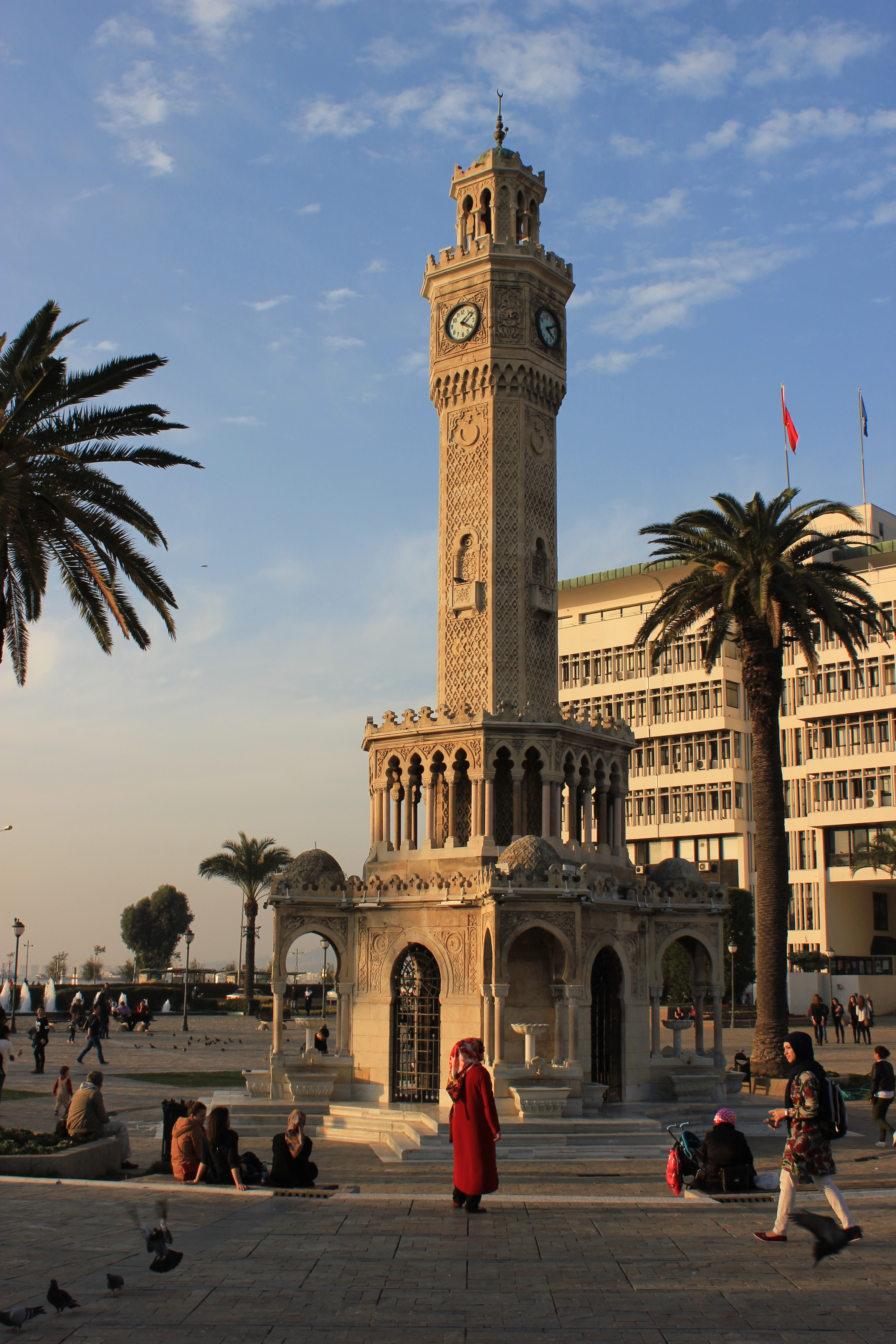
Izmir Clock Tower

Izmir_Clock_Tower.jpg


?zmir has almost 3,500 years of recorded urban history and possibly even longer as an advanced human settlement. Lying on an advantageous location at the head of a gulf running down in a deep indentation midway on the western Anatolian coast, the city has been one of the principal mercantile cities of the Mediterranean Sea for much of its history. Its port is Turkey's primary port for exports in terms of the freight handled and its free zone, a Turkish-U.S. joint-venture established in 1990, is the leader among the twenty in Turkey. Its workforce, and particularly its rising class of young professionals, concentrated either in the city or in its immediate vicinity (such as in Manisa and Turgutlu), and under either larger companies or SMEs, affirm their name in an increasingly wider global scale and intensity. ?zmir is widely regarded as one of the most progressive Turkish cities in terms of its values, lifestyle, dynamism and gender roles.

Politically, it is considered a stronghold of the Republican People's Party.

Izmir is also famous with its girls.The most beautiful girls of Turkey in Izmir.

Izmir Ataturk Stadium

izmir_Ataturk_Stadi.jpg


Capacity: 51,295

Record attendance: 68,034 (Turkey - Malta)


?zmir Atatürk Stadium (Turkish: ?zmir Atatürk Stadyumu) is a multi-purpose stadium in ?zmir, Turkey.It is currently used mostly for football matches. The stadium holds 51,295 people.It was built in 1964,and most recently refurbished in 2005. ?zmir football teams Kar??yaka S.K. and Göztepe A.?. occasionally use the stadium for high attendance matches.

The stadium hosted the 1971 Mediterranean Games and the 2005 Summer Universiade. The stadium also hosted the Fortis Turkey Cup Final in 2009 in which Be?ikta? beat Fenerbahçe 4-2 to reach the cup for the 8th time.

The stadium was named after the Turkish statesman Mustafa Kemal Atatürk.​
 

Stella

Active member
Joined
November 30, 2009
Posts
4,500
Location
Romania
1st city in Romania-Bucharest
[youtube:3ruklwau]Z4F0F5XCUfo&feature=related[/youtube:3ruklwau]
bucuresti.jpg

Bucharest is the capital city, industrial, cultural, and financial centre of Romania. It is the largest city in Romania, located in the southeast of the country, at 44°25?57?N 26°06?14?ECoordinates: 44°25?57?N 26°06?14?E, and lies on the banks of the Dâmbovi?a River.
Bucharest is the 6th largest city in the European Union by population within city limits.

Economically, Bucharest is the most prosperous city in Romania[10] and is one of the main industrial centres and transportation hubs of Eastern Europe. The city has a broad range of convention facilities, educational facilities, cultural venues, shopping arcades and recreational areas.
Arcul_de_Triumph.jpg

The city proper is administratively known as the Municipality of Bucharest (Municipiul Bucure?ti), and has the same administrative level as a county, being further subdivided into six sectors.
Twin towns—Sister cities
Bucharest has 18 twin towns and sister cities, as listed below:[35]
Country City Date
Albania Tirana 2007
Brazil Rio de Jan
eiro 2002
Brazil São Paulo 2000
Bulgaria Sofia
Canada Montreal
China Beijing 2005
Cyprus Nicosia 2004
Greece Athens 1993
Jordan Amman 1999
Moldova Chi?in?u
Nigeria Lagos
Philippines Manila[41]
Russia Moscow
Syria Damascus[35]
Turkey Ankara 1998
Turkey Istanbul
United Kingdom London
United States Atlanta 1994

The National Stadium
stadion_national-proiect.jpg

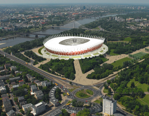
The National Stadium (Romanian: Stadionul Na?ional) is a football stadium currently under construction in Bucharest, Romania, in the Lia Manoliu Sports Complex. It will be ready in late 2010 and it will host Romania's games and the Romanian Cup and Romanian Supercup finals.[3]
The stadium is being built on the site of the former National Stadium, which was completed in 1953.

stadionul%20national0.jpg

The venue will be able to hold 55,200 people but with a potential expansion to 63,000 people. 3,600 VIP seats will be available, and another 126 seats will be allotted for the press (with a possible expansion to 548 seats. The stadium will also include some 360 restrooms and a retractable roof, which can be opened/closed in 15 minutes
stadion.jpg
 

Alexu

Well-known member
Joined
October 1, 2009
Posts
5,039
Location
Bucharest, Romania
KristiG said:
lucian-crusher said:
From -ro to -tr you can go by car and in 16 hours you are there! :D :D

P.S.: Who bided for -ro? :roll: :roll:

Stella.You can see all the biders in the first page ;) :mrgreen:


OMG, again I'm gonna lose Romania :cry: I'm sorry but I won't participate again...
 

Stella

Active member
Joined
November 30, 2009
Posts
4,500
Location
Romania
Alexu said:
KristiG said:
lucian-crusher said:
From -ro to -tr you can go by car and in 16 hours you are there! :D :D

P.S.: Who bided for -ro? :roll: :roll:

Stella.You can see all the biders in the first page ;) :mrgreen:


OMG, again I'm gonna lose Romania :cry: I'm sorry but I won't participate again...
Alexu,I promise I will let you Romania.And if it's possible,I will take it for you.It's ok? :)
 

goktengri

Banned
Joined
June 16, 2010
Posts
14,347
Location
Turkish Republic
[center:1uiqw0hj]2nd Host city in Turkey: Ankara

ankara%20gece%20goruntusu.jpg

ankara_turu.jpg


Region: Central Anatolia

Ankara is the capital of Turkey and the country's second largest city after Istanbul. The city has a mean elevation of 850 metres (2,790 ft), and as of 2007 the city had a population of 3,763,591. Ankara also serves as the capital of Ankara Province.

As with many ancient cities, Ankara has gone by several names over the ages: The Hittites gave it the name Ankuwash before 1200 BC. The Galatians and Romans called it Ancyra. In the classical, Hellenistic, and Byzantine periods it was known as ?????? (Ánkyra, meaning Anchor) in Greek. The city was also known in the European languages as Angora after its conquest by the Seljuk Turks in 1073, and continued to be internationally called with this name until it was officially renamed Ankara with the Turkish Postal Service Law of 1930.

Following the Ottoman defeat at World War I, the Ottoman capital Istanbul and much of Anatolia were occupied by the Allies, who planned to share these lands between Armenia, France, Greece, Italy and the United Kingdom, leaving for the Turks the core piece of land in central Anatolia. In response, the leader of the Turkish nationalist movement, Mustafa Kemal Atatürk, established the headquarters of his resistance movement in Ankara in 1920 (see the Treaty of Sèvres and the Turkish War of Independence.) After the War of Independence was won and the Treaty of Sèvres was superseded by the Treaty of Lausanne, the Turkish nationalists replaced the Ottoman Empire with the Republic of Turkey on 29 October 1923. A few days earlier, Ankara had officially replaced Istanbul (formerly Constantinople) as the new Turkish capital city, on 13 October 1923.

After Ankara became the capital of the newly founded Republic of Turkey, new development divided the city into an old section, called Ulus, and a new section, called Yeni?ehir. Ancient buildings reflecting Roman, Byzantine, and Ottoman history and narrow winding streets mark the old section. The new section, now centered around K?z?lay, has the trappings of a more modern city: wide streets, hotels, theaters, shopping malls, and high-rises. Government offices and foreign embassies are also located in the new section.

Ankara has experienced a phenomenal growth since it was made Turkey's capital. It was "a small town of no importance"
when it was made the capital of Turkey. In 1924, the year after the government had moved there, Ankara had about 35,000 residents. By 1927 there were 44,553 residents and by 1950 the population had grown to 286,781.

Turkish Angora (Ankara) Cat

ankara_kedisi.jpg


The Turkish Angora (Turkish: Ankara Kedisi) is a breed of domestic cat. Turkish Angoras are one of the ancient, naturally-occurring cat breeds, having originated in central Turkey, in the Ankara region.

Anitkabir

anitkabir-b.jpg


An?tkabir (literally, "memorial tomb") is the mausoleum of Mustafa Kemal Atatürk, the leader of the Turkish War of Independence and the founder and first president of the Republic of Turkey. It is located in Ankara and was designed by architects Professor Emin Onat and Assistant Professor Orhan Arda, whose proposal beat 48 other entries from several countries in a competition held by the Turkish Government in 1941 for a "monumental mausoleum" for Atatürk.

The site is also the final resting place of ?smet ?nönü, the second President of Turkey, who was interred there after he died in 1973. His tomb faces the Atatürk Mausoleum, on the opposite side of the Ceremonial Ground.

The mausoleum was depicted on various Turkish banknotes during 1966-1987 and 1997-2009.

Ethnography Museum of Ankara

074_Etnografya.05.2006_resize.JPG


The Ethnography Museum of Ankara built by architect Arif Hikmet Koyuno?lu, is located on the site of a Muslim cemetery on a hill at Namazgah in Ankara, Turkey. The hill was granted to the Ministry of National Education in order for the museum to be built according to Decree of Cabinet of Ministers dated November 15, 1925 by General Directorate of Charity Foundations.

Cebeci Inonu Stadium

Cebeci_Inonu2.jpg


Capacity: 37.000

Cebeci ?nönü Stadium (Turkish: Cebeci ?nönü Stad?) is a multi-purpose stadium in Ankara, Turkey. It is currently used mostly for football matches and was the home stadium of Gençlerbirli?i OFTA?. The stadium holds 37,000 people and was built in 1967. It was named after the Turkish statesman ?smet ?nönü.[/center:1uiqw0hj]
 

DominikS

Active member
Joined
March 1, 2010
Posts
1,042
Location
UK/Poland
WARSAW

Warsaw or Warszawa is Poland's capital and largest city. It has a high standard of living, complete with all the modern amenities for a satisfied citizen. The city of Warsaw is truly an unforgettable destination for tourists.
Skyscapers shoot upwards as Warsaw's economic status rises and the city continues to gather foreign investors. With a fine location, Warsaw is blessed with the Vistula River flowing through the city.
Warsaw3.jpg

Having signed the Schengen Agreement and the EU, it is convenient for travellers to travel in and out of Warsaw as well as experience local transit provided with style.
As the historical areas of Warsaw give air of its celebrated past, the developing plans and constructions of modern institutions mark Warsaw as one of the world's prime cities.
warsaw.jpg


The beginnings

Although almost 700 years old, Warsaw is considered to be a young city by Polish standards. Warsaw was only starting to emerge as a city from the Mazovian forest, when citys such as: Krakow, Gdansk, Wroclaw or Kalisz were celebrating their quince centenaries.
Warsaw only became the capital of Poland in 1596 after a fire in the King's castle in Kraków. The parliament resided in the city since 1596 and was the place for the Polish-Lithuanian elections.

pl-warsaw-02-380x285-royal-bath.jpg


The city boomed in the 18th century. It was during this period that many of the palaces, churches and monasteries were erected and the cultural life flourished, especially during the reign of the last Polish king Stanislaw August Poniatowski.

poland_warsaw_10.jpg


By 1795 Poland had been totally partitioned by three countries: Prussia, Russia and the Austro-Hungarians. Warsaw found itself under the Prussian rule and its role was diminished to that of a small provincial town. Once more in 1807 Warsaw became the capital, when Napoleon created the Duchy of Warsaw. With the collapse of Napoleonic France, in 1830 Warsaw fell to the Russian rule. Despite during the Russian occupation Warsaw continued in its steady development along with a steady population increase, by 1900 Warsaw had 700,000 inhabitants.

1944: Warsaw Uprising

The Warsaw Uprising was a struggle by the Polish resistance organization, the Home Army, to liberate Warsaw from Nazi German occupation during World War II, before the arrival of the Soviet Army. The Uprising began on 1 August 1944, as part of a nationwide rebellion, Operation Tempest. The rebellion was intended to last for only a few days until the communists reached the city. The Soviet advance stopped short, however, while Polish resistance against the German forces continued for 63 days until the Polish surrendered.

483px-Warszawa_Powstanie_1944-08-04.jpg


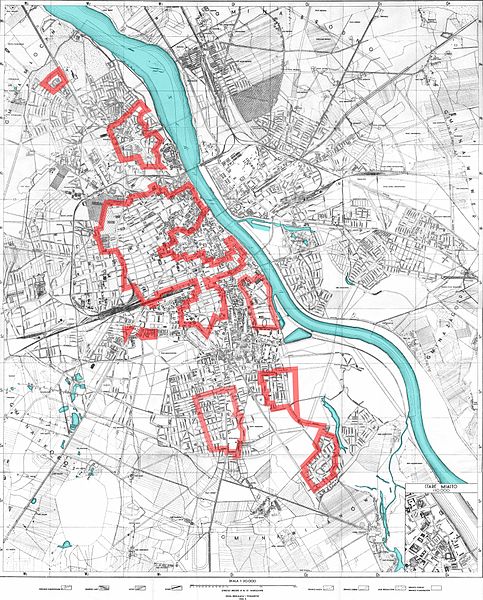
Although the exact number of casualties remains unknown, it is estimated that about 16,000 members of the Polish resistance were killed and about 6,000 badly wounded. In addition, between 150,000 and 200,000 civilians died, mostly from mass murders conducted by troops fighting on the German side. German casualties totaled over 2,000 soldiers killed, 7,000 missing, and 9,000 wounded. During the urban combat approximately 25% of Warsaw's buildings were destroyed. Following the surrender of Polish forces, German troops systematically leveled 35% of the city block by block. Together with earlier damage suffered in the invasion of Poland (1939) and the Warsaw Ghetto Uprising (1943), over 85% of the city was destroyed by January 1945, when the Soviets entered the city.

g66j.jpg


After 1945

20043-004-81A7984F.jpg


The survivors came back to their city almost immediately and started to rebuild it. Warsaw again became the capital of Poland. But once more its fate was really determined by Moscow, a fact symbolized by the Palace of Culture( originally named in honor of Joseph Stalin) towering over the city center since 1955. The city was the first of all capitals in the former Warsaw Pact to hold democratic elections in 1989.

Today

Today the city is the biggest city in Poland, full of culture and optimism about the future. The city centre boasts both historic palaces and buildings as well as skyscrapers that match their Western European rivals (Warsaw has one of the tallest skyscrapers in the EU)

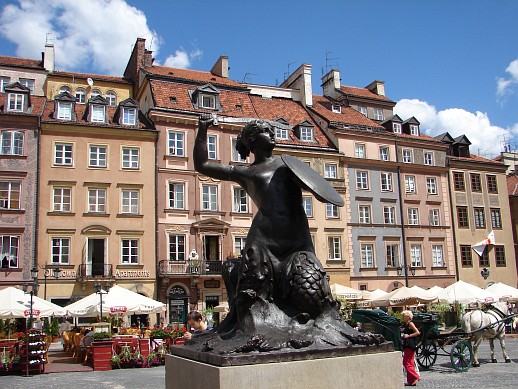
O_T_M_S_Warsaw_Sireneax_s.jpg
 

AlekS

Veteran
Joined
October 1, 2009
Posts
26,905
Location
Ukraine
:al: :al: :al: :al: :ua: :ua: :ua: :ua:

The 1st host city: KYIV

0000_10.png

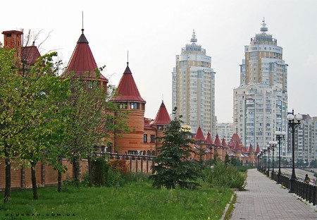
Kyiv is the capital and the largest city of Ukraine, located in the north central part of the country on the Dnieper River. The population as of the 2008 census was 2 820 000. The total amount (+ unofficial citizens) goes past 3.1 million in 2010.

STx_1445-1449_small.jpg


Kyiv is an important industrial, scientific, educational and cultural centre of Eastern Europe. It is home to many high-tech industries, higher education institutions and world-famous historical landmarks. The city has an extensive infrastructure and highly developed system of public transport, including the Kyiv Metro. Kyiv was classified as a Beta global city as of 2004.

300312_88e0e7a5.jpg


_MG_2570_SM_SM.jpg

The name Kyiv is said to derive from the name of Kyi, one of four legendary founders of the city (brothers Kyi, Shchek, Khoryv, and sister Lybid). During its history, Kyiv, one of the oldest cities in Eastern Europe, passed through several stages of great prominence and relative obscurity. The city may have been founded in the 5th century as a trading post, perhaps part of the land of the early Slavs. It gradually acquired eminence as the centre of the East Slavic civilization, becoming in the tenth to twelfth centuries a political and cultural capital of Rus', a medieval East Slavic state. Completely destroyed during the Mongol invasion in 1240, the city lost most of its influence for the centuries to come. It was a provincial capital of marginal importance in the outskirts of the territories controlled by its powerful neighbours; first the Grand Duchy of Lithuania, followed by Poland and Russia.

The city prospered again during the Russian Empire's industrial revolution in the late 19th century. After the turbulent period following the Russian Revolution of 1917, from 1921 onwards Kyiv was an important city of the Ukrainian Soviet Socialist Republic, and, from 1934, its capital. During World War II, the city again suffered significant damage, but quickly recovered in the post-war years remaining the third largest city of the Soviet Union. Following the collapse of the Soviet Union and the Ukrainian independence of 1991, Kiev remained the capital of Ukraine.

One of my most fave places (after Dnypro river area) in the city:
"The house with monsters" (yep, this is official name :lol: )
chimera.jpg

+ The night view

The Independence Square
kiev-maidan.jpg


WWII Museum (yep, it's huge)
Motherland-Kiev.jpg


The stadium
"SC Olimpiyskyi"
Capacity: 69 000
th-165-nsk-project.jpg


90404.jpg

The stadium is being totally reconstructed for Euro 2012.​
 

AlekS

Veteran
Joined
October 1, 2009
Posts
26,905
Location
Ukraine
ParadiseES said:
And will we vote the host countries? :D
What do you mean? From the 16th of August to the 31st of August there will be a poll to choose the host(s).
 

ParadiseES

Well-known member
Joined
October 3, 2009
Posts
15,047
Location
Zaragoza (Spain)
OK

So my PM is open for everyone. I openly accept bribes ;)
 

MyHeartIsYours

Well-known member
Joined
May 22, 2010
Posts
24,545
uk-FLAG-map.jpg


profile no.2 / United Kingdom hosting city: MANCHESTER

manchester-aerial.jpg


Manchester is a city and metropolitan borough of Greater Manchester, England. In 2008, the population of the city was estimated to be 464,200, making it the seventh-most populous local authority district in England. Manchester lies within one of the UK's largest metropolitan areas; the metropolitan county of Greater Manchester had an estimated population of 2,562,200, the Greater Manchester Urban Area a population of 2,240,230, and the Larger Urban Zone around Manchester, the second-most-populous in the UK, had an estimated population in the 2004 Urban Audit of 2,539,100. The demonym of Manchester is Mancunian.
Manchester is situated in the south-central part of North West England, fringed by the Cheshire Plain to the south and the Pennines to the north and east. The recorded history of Manchester began with the civilian vicus associated with the Roman fort of Mamucium, which was established c. AD 79 on a sandstone bluff near the confluence of the rivers Medlock and Irwell. Historically, most of the city was a part of Lancashire, although areas south of the River Mersey were in Cheshire. Throughout the Middle Ages Manchester remained a manorial township, but began expanding "at an astonishing rate" around the turn of the 19th century as part of a process of unplanned urbanisation brought on by a boom in textile manufacture during the Industrial Revolution. The urbanisation of Manchester largely coincided with the Industrial Revolution and the Victorian era, resulting in it becoming the world's first industrialised city. As the result of an early-19th century factory building boom, Manchester was transformed from a township into a major mill town, borough and was later granted honorific city status in 1853.
Forming part of the English Core Cities Group, Manchester today is a centre of the arts, the media, higher education and commerce, factors all contributing to Manchester polling as the second city of the United Kingdom in 2002. In a poll of British business leaders published in 2006, Manchester was regarded as the best place in the UK to locate a business. A report commissioned by Manchester Partnership, published in 2007, showed Manchester to be the "fastest-growing city" economically. In the GaWC global city list, Manchester is ranked as a Gamma city. It is the third-most visited city in the United Kingdom by foreign visitors and the most visited in England outside London. Manchester was the host of the 2002 Commonwealth Games, and among its other sporting connections are its two Premier League football teams, Manchester United and Manchester City.

HISTORY MANCHESTER

IM.1063_zl.jpg


Much of Manchester's history is concerned with textile manufacture during the Industrial Revolution. The great majority of cotton spinning took place in the towns of south Lancashire and north Cheshire, and Manchester was for a time the most productive centre of cotton processing, and later the world's largest marketplace for cotton goods. Manchester was dubbed "Cottonopolis" and "Warehouse City" during the Victorian era. In Australia, New Zealand and South Africa, the term "manchester" is still used for household linen: sheets, pillow cases, towels, etc.
Manchester began expanding "at an astonishing rate" around the turn of the 19th century as part of a process of unplanned urbanisation brought on by the Industrial Revolution. It developed a wide range of industries, so that by 1835 "Manchester was without challenge the first and greatest industrial city in the world." Engineering firms initially made machines for the cotton trade, but diversified into general manufacture. Similarly, the chemical industry started by producing bleaches and dyes, but expanded into other areas. Commerce was supported by financial service industries such as banking and insurance. Trade, and feeding the growing population, required a large transport and distribution infrastructure: the canal system was extended, and Manchester became one end of the world's first intercity passenger railway—the Liverpool and Manchester Railway. Competition between the various forms of transport kept costs down. In 1878 the GPO (the forerunner of British Telecom) provided its first telephones to a firm in Manchester.
The Manchester Ship Canal was built in 1894, in some sections by canalisation of the Rivers Irwell and Mersey, running 58 kilometres (36 mi) from Salford to Eastham Locks on the tidal Mersey. This enabled ocean going ships to sail right into the Port of Manchester. On the canal's banks, just outside the borough, the world's first industrial estate was created at Trafford Park. Large quantities of machinery, including cotton processing plant, were exported around the world.
A centre of capitalism, Manchester was once the scene of bread and labour riots, as well as calls for greater political recognition by the city's working and non-titled classes. One such riot ended with the Peterloo Massacre of 16 August 1819. The economic school of Manchester capitalism developed there, and Manchester was the center of the Anti-Corn Law League from 1838 onward.

GEOGRAPHY MANCHESTER

002091_f26500fe.jpg


At 160 miles (257 km) northwest of London, Manchester lies in a bowl-shaped land area bordered to the north and east by the Pennine hills, a mountain chain that runs the length of northern England and to the south by the Cheshire Plain. The city centre is on the east bank of the River Irwell, near its confluences with the Rivers Medlock and Irk, and is relatively low-lying, being between 115 to 138 feet (35 and 42 m) above sea level. The River Mersey flows through the south of Manchester. Much of the inner city, especially in the south, is flat, offering extensive views from many highrise buildings in the city of the foothills and moors of the Pennines, which can often be capped with snow in the winter months. Manchester's geographic features were highly influential in its early development as the world's first industrial city. These features are its climate, its proximity to a seaport at Liverpool, the availability of water power from its rivers, and its nearby coal reserves.
Manchester experiences a temperate maritime climate, like much of the British Isles, with warm summers and cold winters. There is regular but generally light precipitation throughout the year. The city's average annual rainfall is 806.6 millimetres (31.76 in) compared to the UK average of 1,125.0 millimetres (44.29 in), and its mean rain days are 140.4 per annum, compared to the UK average of 154.4. Manchester however has a relatively high humidity level, which optimised the textile manufacturing (with low thread breakage) which took place there. Snowfalls are not common in the city, due to the urban warming effect. However, the Pennine and Rossendale Forest hills that surround the city to its east and north receive more snow and roads leading out of the city can be closed due to snow. notably the A62 road via Oldham and Standedge, the A57 (Snake Pass) towards Sheffield, and the M62 over Saddleworth Moor.

TRANSPORT MANCHESTER

No_3001_Manchester_Metrolink_tram.jpg


Manchester and North West England are served by Manchester Airport. The airport is the busiest in terms of passenger traffic in the UK outside London, serving 21.06 million passengers in 2008. Airline service exists to many destinations in Europe, North America, the Caribbean, Africa, the Middle East and Asia (with more destinations from Manchester than from London Heathrow). A second runway was opened in 2001 and there have been continued terminal improvements. Passenger figures have been virtually static since 2005.
Manchester is well served by trains. In terms of passengers, Manchester Piccadilly was the busiest English railway station outside London in 2005 and 2006. Local operator Northern Rail and First Transpennine Express operates all over the north of England, and other national operators include East Midlands Trains and Virgin Trains. The Liverpool and Manchester Railway was the first passenger railway in the world. Greater Manchester has an extensive countywide railway network, and two mainline stations. Manchester city centre is also serviced by over a dozen rail-based park and ride sites. In October 2007, the government announced that a feasibility study had been ordered into increasing the capacity at Piccadilly station and turning Manchester into the rail hub of the north.
Manchester became the first city in the UK to acquire a modern light rail tram system when the Manchester Metrolink opened in 1992. The present system mostly runs on former commuter rail lines converted for light rail use, and crosses the city centre via on-street tram lines. The 23 mi (37 km)-network consists of three lines with 37 stations (including five on-street tram stops in the centre). An expansion programme is underway.
The city has one of the most extensive bus networks outside London with over 50 bus companies operating in the Greater Manchester region radiating from the city. Prior to the deregulation of 1986, SELNEC and later GMPTE operated all buses in Manchester. The bus system was then taken over by GM Buses which after privatisation was split into GM Buses North and GM Buses South and at a later date taken over by First Manchester and Stagecoach Manchester respectively. First Manchester also operates a three route zero-fare bus service called Metroshuttle which carries commuters around Manchester's business districts.
An extensive canal network remains from the Industrial Revolution, nowadays mainly used for leisure. The Manchester Ship Canal is open, but traffic to the upper reaches is light.

CULTURE MANCHESTER

afc50c6fc444435b88a26139f7fe09fd.jpg


Bands that have emerged from the Manchester music scene include The Smiths, the Buzzcocks, The Fall, Joy Division and its successor group New Order, Oasis and Doves. Manchester was credited as the main regional driving force behind indie bands of the 1980s including Happy Mondays, Inspiral Carpets, James, and The Stone Roses. These groups came from what became known as the "Madchester" scene that also centred around the Fac 51 Haçienda (also known as simply The Haçienda) developed by founder of Factory Records Tony Wilson. Although from southern England, The Chemical Brothers subsequently formed in Manchester. Ex-Stone Roses' frontman Ian Brown and ex-Smiths Morrissey continue successful solo careers. Other notable Manchester acts include Take That and Simply Red. Greater Manchester natives include A Guy Called Gerald, Richard Ashcroft of The Verve and Jay Kay of Jamiroquai. Older Manchester artists include the 1960s band's The Hollies, Herman's Hermits and the Bee Gees who, while commonly associated with Australia, grew up in Chorlton.
Manchester has a thriving theatre, opera and dance scene, and is home to a number of large performance venues, including the Manchester Opera House, which feature large-scale touring shows and West End productions; the Palace Theatre; the Royal Exchange Theatre in Manchester’s former cotton exchange; and the Lowry Centre, a touring venue in Salford which often hosts performances by Opera North.
Manchester's museums celebrate Manchester's Roman history, rich industrial heritage and its role in the industrial revolution, the textile industry, the Trade Union movement, women's suffrage and football. In the Castlefield district, a reconstructed part of the Roman fort of Mamucium is open to the public in Castlefield. The Museum of Science and Industry, housed in the former Liverpool Road railway station, has a large collection of steam locomotives, industrial machinery and aircraft. The Museum of Transport displays a collection of historic buses and trams. Salford Quays, a short distance from the city centre in the adjoining borough of Trafford, is home to the Imperial War Museum North. The Manchester Museum opened to the public in the 1880s, has notable Egyptology and natural history collections.
The municipally-owned Manchester Art Gallery on Mosley Street houses a permanent collection of European painting, and has one of Britain's most significant collections of Pre-Raphaelite paintings.
The night-time economy of Manchester has expanded significantly since about 1993, with investment from breweries in bars, public houses and clubs, along with active support from the local authorities. The more than 500 licensed premises in the city centre have a capacity to deal with over 250,000 visitors, with 110–130,000 people visiting on a typical weekend night. The night-time economy has a value of about £100 million pa and supports 12,000 jobs.

GAY MANCHESTER - CANAL STREET

23199_canal_street.jpg


Canal Street was built when the Rochdale Canal was made, with pubs built to service the users of the canal. By the 1960s, usage of the canal had greatly declined due to competition from other methods of transport and the collapse of the cotton industry in Northern England. To begin with this was mainly a lesbian-orientated area but as the years went by it gradually become a focus for gay men. The area along the canal was perfect for gay men to clandestinely meet as it was dark and unvisited, but was near to good transport links such as Oxford Road and Piccadilly railway stations.
This focus led to several of the pubs on or near Canal Street acquiring a predominantly gay clientele. In 1991 Manto (Manchester Today) bar opened. Unlike the other gay bars at that time, Manto had large glass windows, allowing the casual passer-by to view what was going on inside. Previously many establishments catering for the gay community were often keen to conceal activities from the general public, but the architectural design of Manto was seen as a queer visual statement "we're here, we're queer – get used to it". A brick-and-mortar refusal to hide any more, to remain underground and invisible.
Over the next decade, more and larger bars opened along the canal side, turning Canal Street into the centre of the most successful gay village in Europe. Because of this, the Canal Street street signs are regularly defaced to read "Anal Treet" or "Anal Street". The success was further enhanced by the use of Canal Street and its bars in several television series, including Bob and Rose and Queer as Folk, both written by Russell T Davies.

THE VENUE - MEN ARENA

Manchesterarena.jpg

images


The M.E.N. Arena is one of the world's busiest indoor arenas and concert venue.[1] The arena was built to coincide with Manchester's two bids to host the Olympic games in 1996 and 2000 (which were won by Atlanta in 1996 and Sydney in 2000).
The M.E.N. Arena was one of the first indoor venues in Europe to be built following the traditionally American sports arena layout of 360 degree seating, and is the only arena in the UK to have this feature (London's O2 Arena also has 360 degrees seating, but only on its lower tier, whereas the M.E.N. Arena features it on both tiers). Other European indoor venues built to the same concept include the Kölnarena in Cologne, Zagreb Arena in Zagreb, Spaladium Arena in Split, Belgrade Arena in Belgrade, O2 arena in Prague, Color Line Arena in Hamburg, and similarly The O2 arena in London.
The arena's seating capacity is one of Europe's most dynamic for an indoor venue. It is often chosen by touring acts because its design and layout makes the venue ideal for any type of performance. One day the arena could host an ice rink, the next day a concert, the next day a basketball match. The seating is split into an upper tier (bowl) and a lower tier, separated by 35 hospitality suites.
It plays host to many worldwide performing artists, including some of the biggest stars in the world of music, including, but not limited to Queen + Paul Rodgers, Aerosmith, McFly, Westlife, Paul McCartney, Celine Dion, Madonna, Rihanna, Kanye West, Andrea Bocelli, N.E.R.D, Pixie Lott, The Police, Whitney Houston, Gorillaz, Cher, The Rolling Stones, Roger Waters, David Bowie, Shakira, U2, Alice Cooper, Metallica, Slipknot, Sting, Red Hot Chili Peppers, Barbara Streisand, Elton John, Tom Jones, Nelly Furtado, Santana, Coldplay, Blur, Usher, Mariah Carey, Def Leppard, Bob Dylan, Britney Spears, Beyoncé, Lemar, New Kids on the Block, Lady Gaga, Stevie Wonder, Kylie Minogue, P!nk, Alicia Keys, Dolly Parton, Jennifer Lopez, Jay-Z, Ne-Yo, Pearl Jam, Andre Rieu, Foo Fighters, Kings of Leon, John Mayer, Bon Jovi, Backstreet Boys, Green Day, Cheryl Cole, Michael Bublé, Spice Girls, Shania Twain, Keri Hilson, Destiny's Child, Christina Aguilera, Gwen Stefani, Tina Turner, Mary J. Blige, Santogold, Miley Cyrus, Linkin Park, Bullet For My Valentine, Lily Allen, The Black Eyed Peas, Dizzee Rascal, Taylor Swift, Avril Lavigne, Robbie Williams, Take That, Genesis, Luciano Pavarotti, Leona Lewis, Cascada, JLS, Kid Cudi, Justin Timberlake & Guns N' Roses, among others.
The arena has a capacity of 23000 and is the largest in Europe.

gdgdgdfgfdfgdfdf.png

VOTE POLAND AND UNITED KINGDOM FOR FSC EURO CUP HOSTS
 

goktengri

Banned
Joined
June 16, 2010
Posts
14,347
Location
Turkish Republic
[center:3eo2fvu7]3rd Host city in Turkey: Antalya

antalya_gece_resmi.jpg

antalya_kaleici.jpg

antalya_konyaalti_plaji.jpg


Region: Mediterranean

Mayor: Mustafa Akayd?n (Republican People's Party)


Antalya (from Greek "????????" - Attaleia) is a city on the Mediterranean coast of southwestern Turkey, and the capital city of Antalya Province. Situated on coastal cliffs, Antalya is surrounded by mountains. Development and investment, begun in the 1970s, have transformed the city into an international resort.

Statue of Attalos II

attalos.jpg


Hidirlik Tower

hdrlk_kalesi.JPG


Lower Duden Fall

asagi-duden-selalesi-001.jpg


Tourism in Antalya

antalya-turkey.jpg


Antalya is one of the world's and the Mediterranean's leading tourism destinations, the city being home to an array of famous attractions. It attracts 30% of foreign tourists visiting Turkey. It has 72 five-star hotels as many as any other city in the world.

Yagmur Sarigul (from MaNga) is from Antalya.

Antalya Ataturk Stadium

Tribunelangezijde.jpg


Capacity: 11,137

Antalya Atatürk Stadium (Turkish: Antalya Atatürk Stadyumu) is a multi-purpose stadium in Antalya, Turkey. It is currently used mostly for football matches and hosts the home games of Antalyaspor. The stadium holds 11,137.[/center:3eo2fvu7]
 

AlekS

Veteran
Joined
October 1, 2009
Posts
26,905
Location
Ukraine
[center:1f3vms4i]-al -al -al -al -ua -ua -ua -ua

The 2nd host city: TIRANA
dsc0149wu.jpg


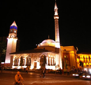
Tirana (Albanian: Tiranë or Tirana) is the capital and the largest city of Albania. Modern Tirana was founded in 1614 by Sulejman Pasha. Tirana became Albania's capital city in 1920. As of 2008, the city's urban population was officially estimated at 618,431.

501562.jpg


In 2000, the centre of Tirana, from the central campus of Tirana University up to Skanderbeg Square was declared the place of Cultural Assembly, and given special claims to state protection. In the same year, the area began a process of restoration under the name ‘Return to Identity’. The area to the west of the university, adjacent to Shën Prokopi Park, was formerly reserved for the occupation of important government and party officials. It remains a desirable residential area.

TAIVANI%20tirana_08.jpg


Tirana is Albania's major industrial centre. It has experienced rapid growth and established many new industries since the 1920s. The principal industries include agricultural products and machinery, textiles, pharmaceuticals, and metal products.

tirana.jpg


Tirana began to develop in the beginning of the 16th century, when a bazaar was established, and its craftsmen manufactured silk and cotton fabrics, leather, ceramics and iron, silver, and gold artifacts. Sited in a fertile plain, the Tirana area exported 2,600 barrels of olive oil and 14,000 packages of tobacco to Venice by 1769. In 1901, it had 140,000 olive trees, 400 oil mills, and 700 shops. The TID tower at 85 meters is being constructed in the city. It will redefine architecture in Albania. Tirana has also huge trade centers like City Park at 3 km square.Tourists usually find Tirana a beautiful and charming city, with a lively night life.

tirana.jpg


The venue
Pallati i Kongreseve
Capacity: 2100
Pallati_i_Kongreseve_n%C3%AB_Tiran%C3%AB.jpg
[/center:1f3vms4i]
 
Top Bottom